Trinity Alps Four Lakes Loop
Jump to: Permit / Getting There / Map / Comments

Updated August 2018
If you’re looking for a trail jam packed with unbelievably scenic lakes, peaks, waterfalls, and wildflowers this is the one. A Trinity Alps guidebook describes the Four Lakes Loop as “Disneyland designed” and I would agree. The terrain is almost too gorgeous to be real! The trail visits the spectacular four lakes (Deer, Summit, Diamond, and Luella) as it winds around Siligo Peak (8,169’), the summit of which is a quick scramble off the loop trail.
Growing up in the Bay Area I made frequent trips to the Trinity Alps with a friend's family but hadn’t returned since I was a teenager. I wasn’t exactly sure what to expect years later, especially since the John Muir Trail was still fresh in our minds for comparison. But when Jason and I set off on a week-long California road trip (a compromise of backpacking and surfing to keep us both happy!) I convinced him to spend two nights in the Trinity wilderness and we were blown away.
Itinerary
The trip starts at Long Canyon Trailhead and climbs up the canyon to Deer Creek Pass in over 6 miles (but with nearly 4000’ elevation gain) to join the Four Lakes Loop. The loop itself is another 5.2 miles.
We camped one night at Bee Tree Gap (most of the way up Long Canyon) and one night at Diamond Lake. From Diamond Lake we day hiked the rest of the loop and Siligo Peak, then headed back out the same way. This allowed us to hike the toughest section of the loop with day packs and enjoy the scenery a little more.
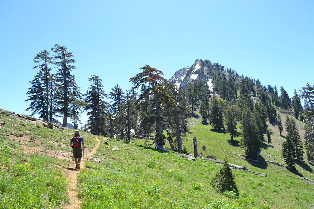
Long Canyon Trailhead to Deer Pass (6.1 miles, +3750 feet)
We stopped at the ranger station in Weaverville to issue our own backcountry and stove permits (no quota). Since this was a high snow season (2017) the ranger explained that there was still a lot of snow and our itinerary might be impacted. The Long Canyon Trailhead was another 45min drive into the mountains and consisted of a dirt lot.
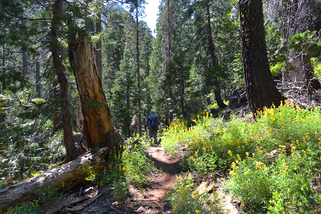
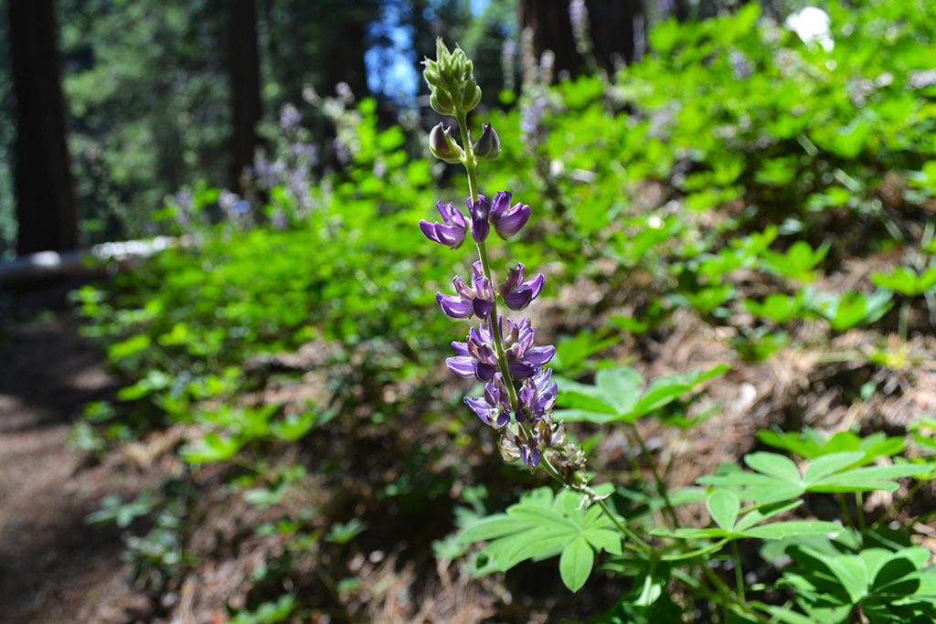
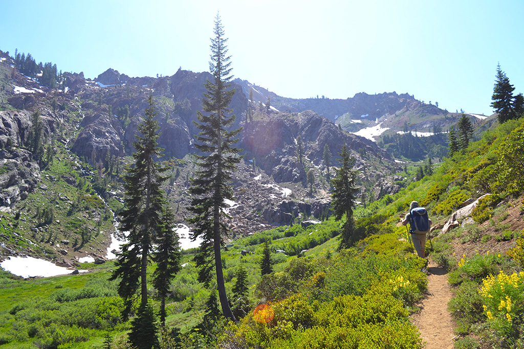
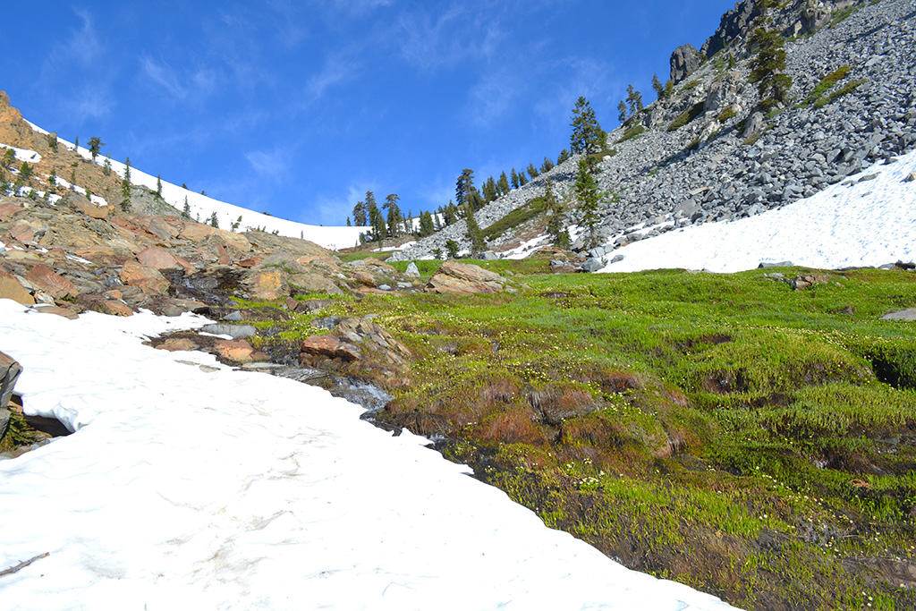
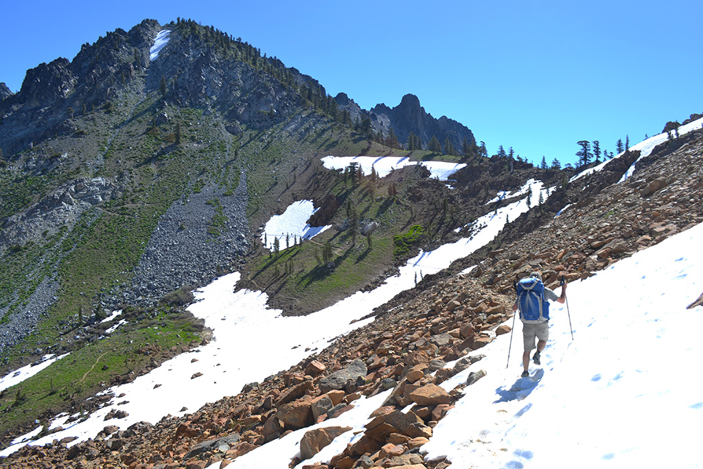
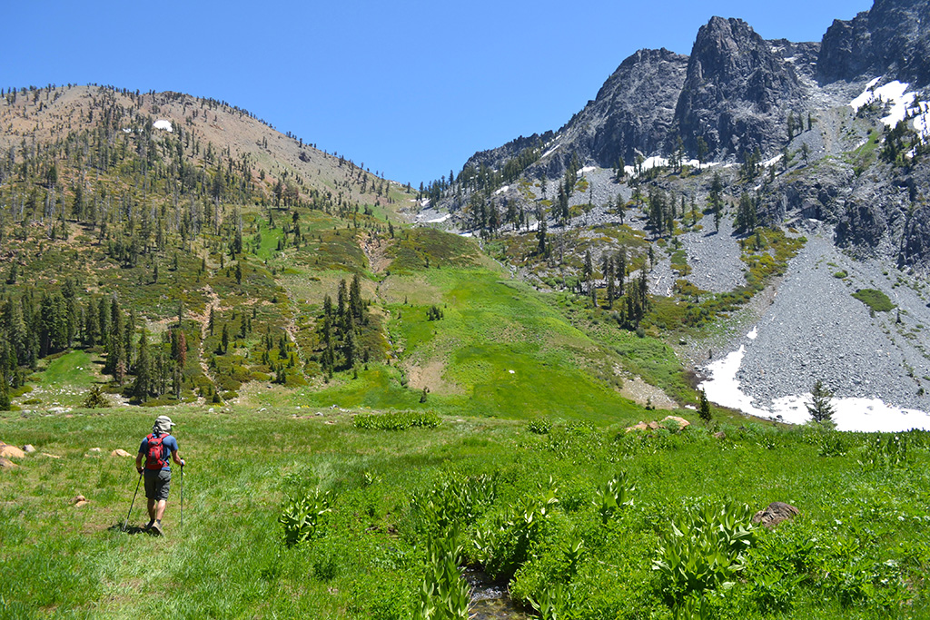
The Long Canyon Trail was almost entirely uphill and quite strenuous after our long drive, but the scenery made up for it. The trail started in a forest with a roaring creek below us. After about 3 miles we were really in the canyon between two sets of mountains. As we climbed up the canyon it became more exposed and the trees opened up to a green meadow full of wildflowers and punctuated by creeks and waterfalls. We started to hike over large snowfields covering the trail, luckily with many footprints to guide us.
The trail wrapped back around to the north toward Bee Tree gap, a small pass. We found an amazing camp spot right on the edge, looking up the gap and also down the valley with the creek beside us.
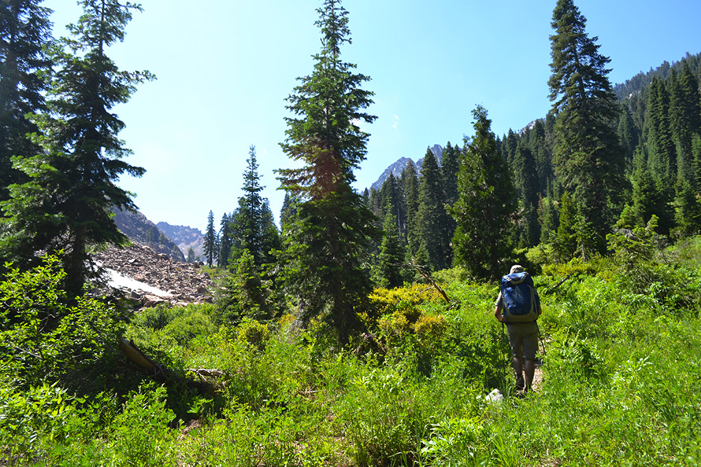
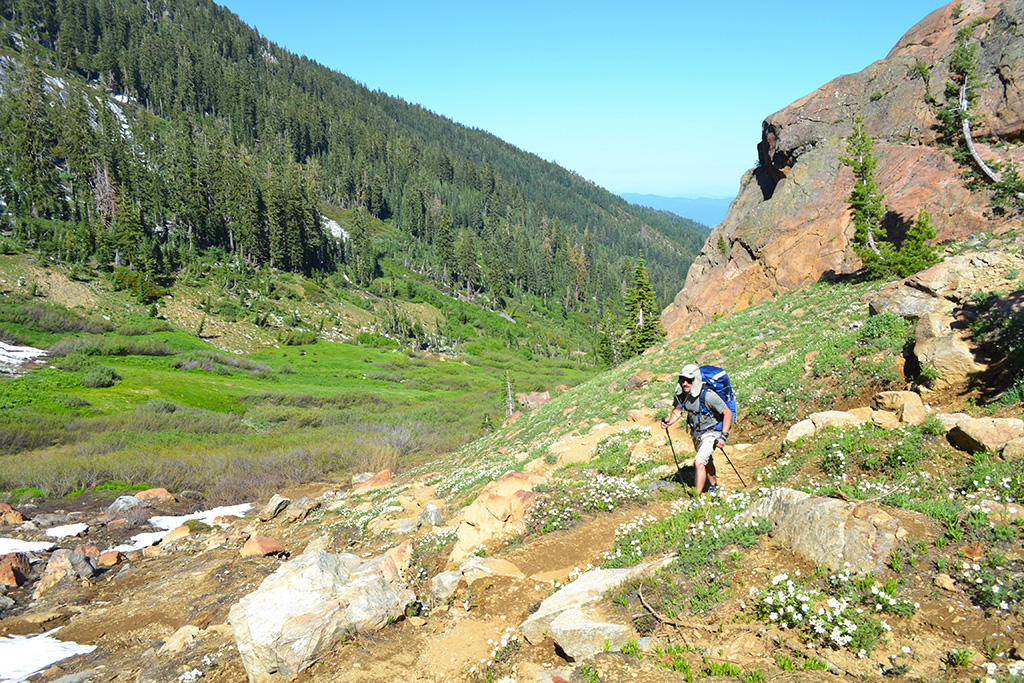
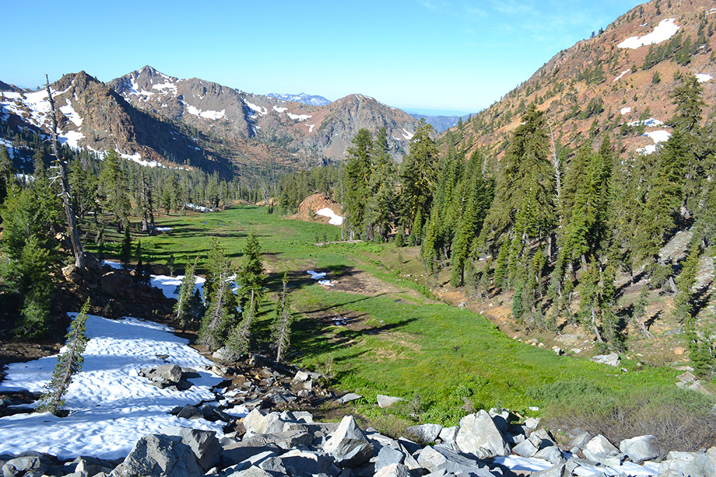
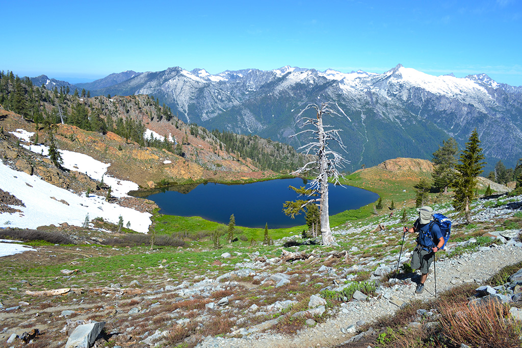
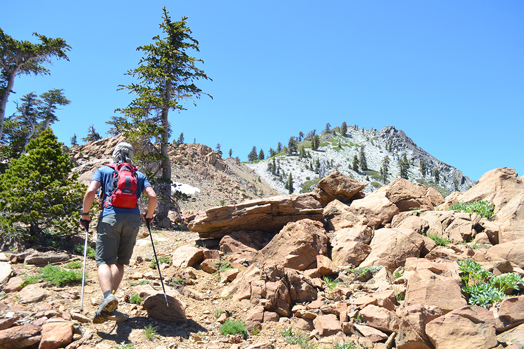
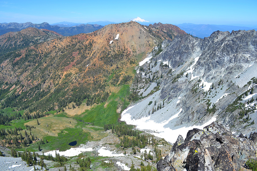
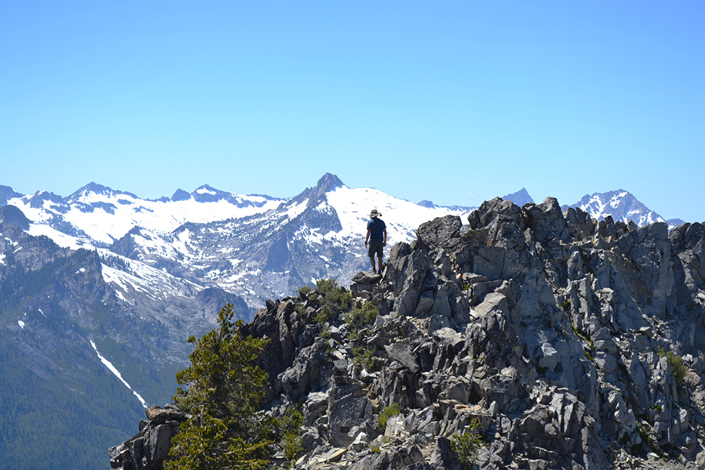
The next morning we climbed Bee Tree Gap and saw several hikers coming down early – many glissading down (sliding on their butts) the snowfield ahead of us. They also gave us a great campsite recommendation: Diamond Lake. At the top of the gap we got a view of lush Siligo meadow below. We took the right fork toward and skirted high up around the meadow to reach Deer Pass, the beginning of our Four Lake Loop.
Four Lakes Loop (5.2 miles, +2000/-2000 feet)
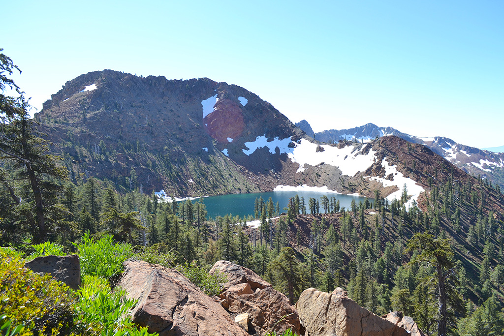
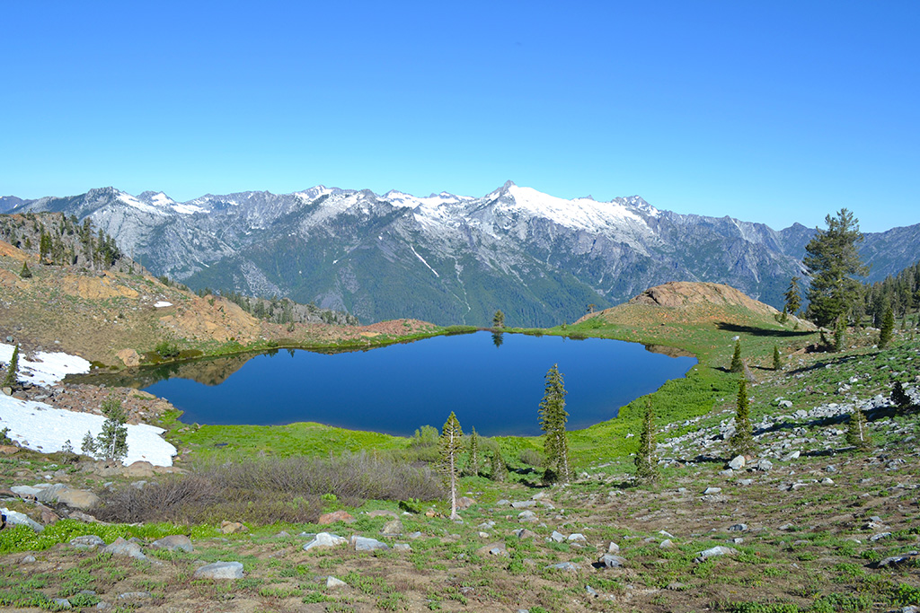
From the top of the pass we were already looking down at our first lake, the deep emerald blue Deer Lake nestled between volcanic-looking mountains of grey, red, and green. The trail continued down a little to reach the loop junction, one side heading down to the outlet of Deer Lake and the other carving a clear path up to the left of Siligo Peak. We stayed left to take the high route direction. We ran into a few snowfields but they were manageable with boots and trekking poles, especially with a trail of footprints already there.
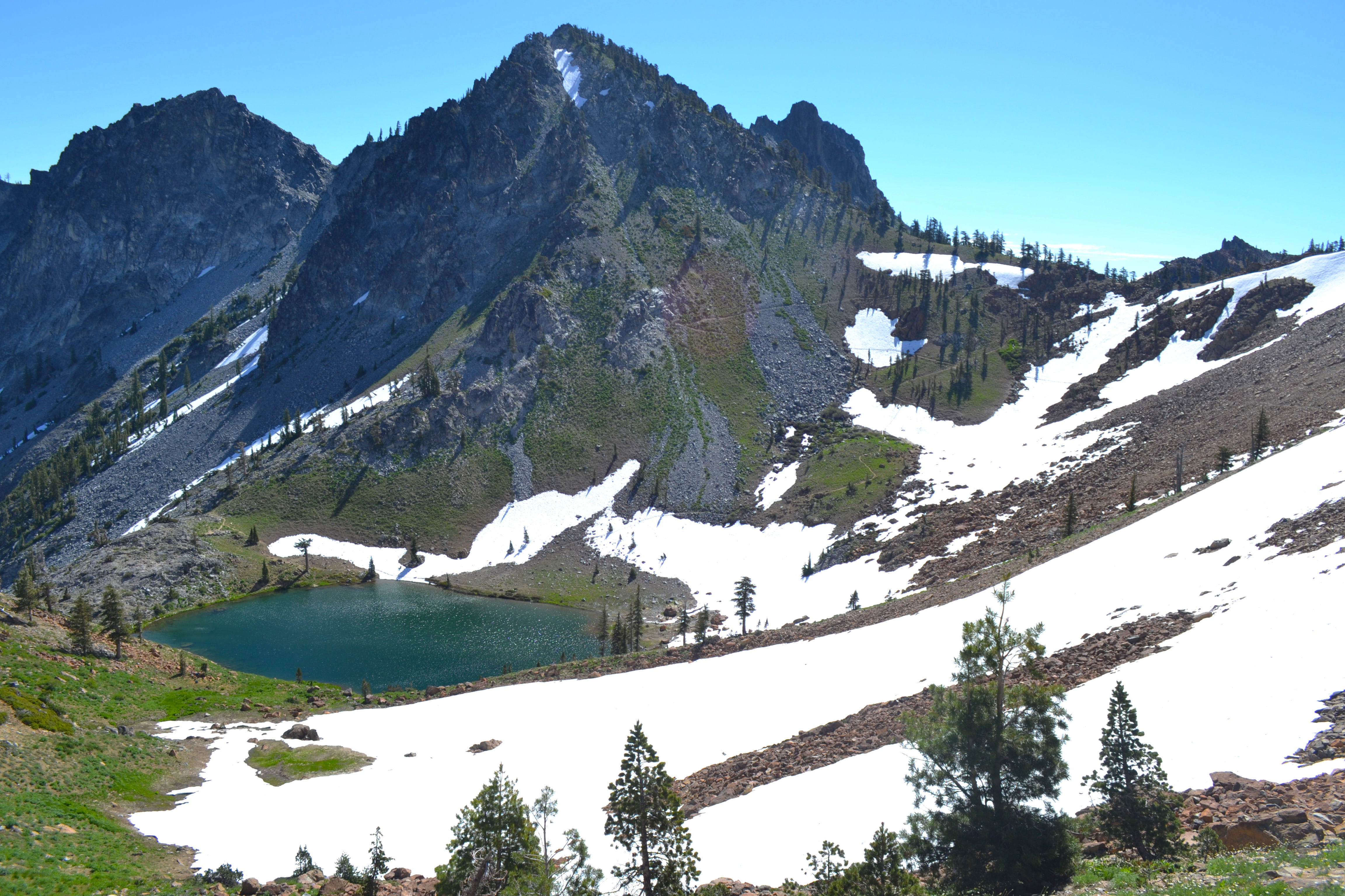
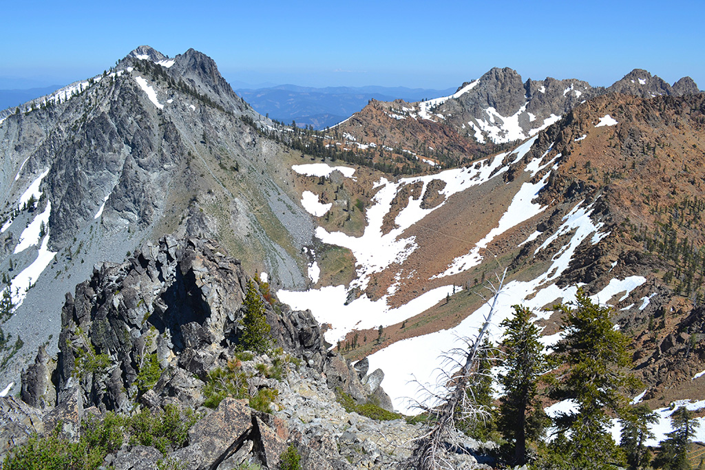
The trail switchbacked up to a ridge where we could immediately see Summit Lake below on our left. At that point I was kind of in disbelief at what I was seeing and realized that the “Disneyland” description was an understatement! The trail continued to hug Siligo Peak on our right as we looked down into the bowl of mountains surrounding pristine Summit Lake. This probably would’ve been my second choice for a campsite.
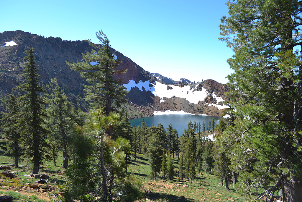
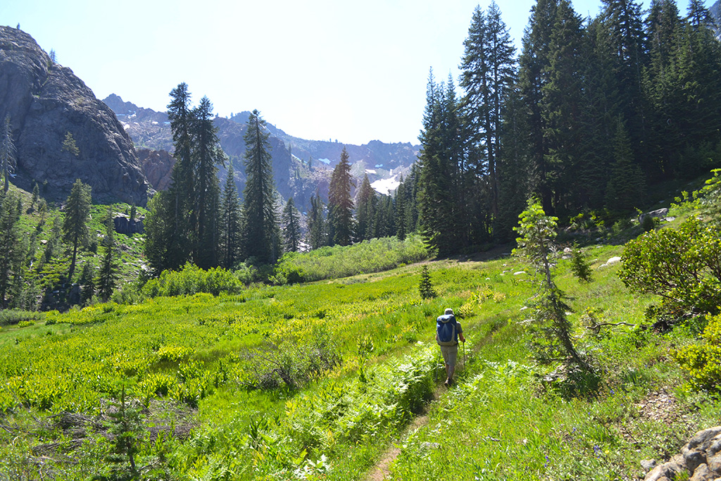
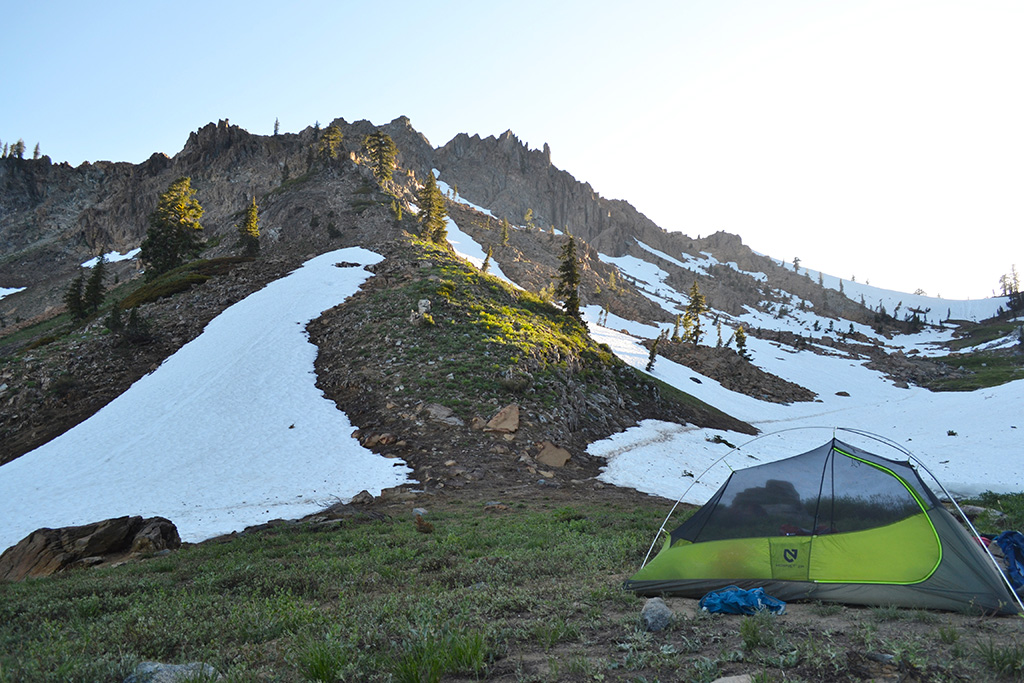
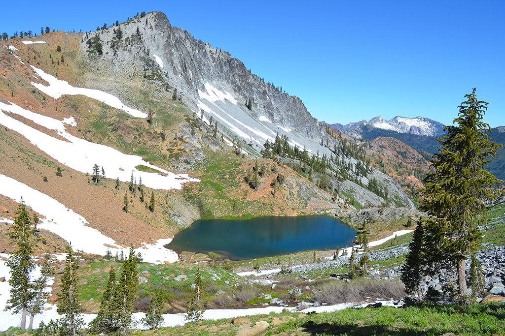
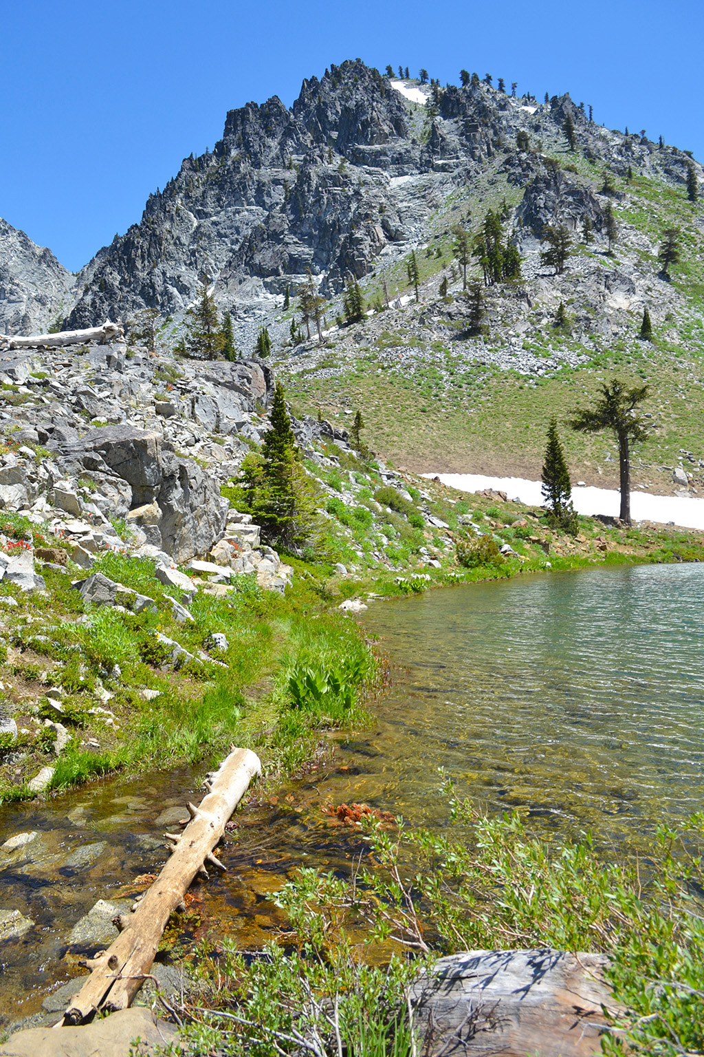
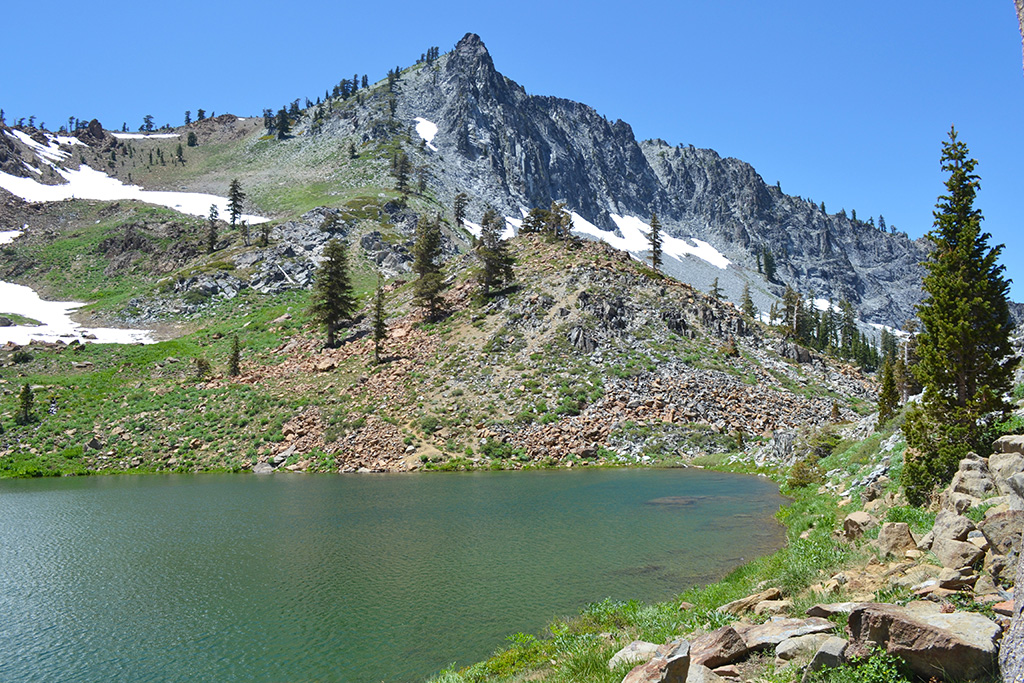
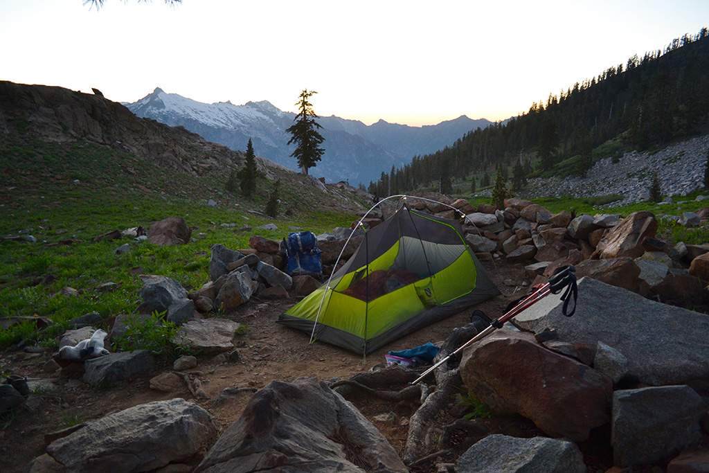
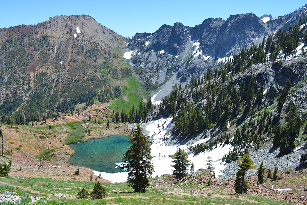
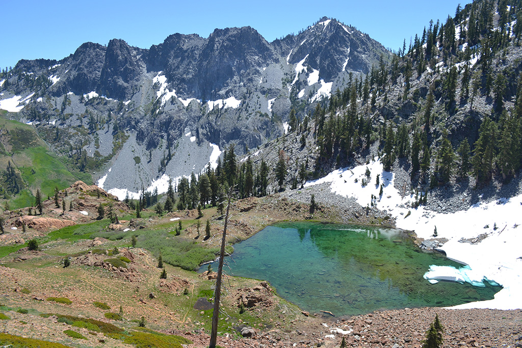
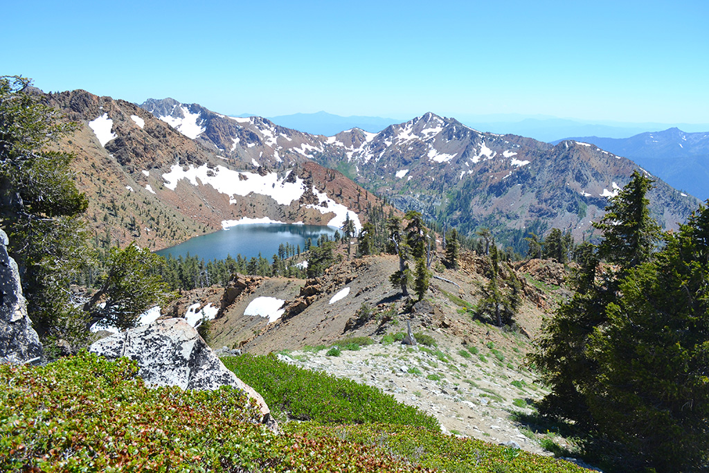
After a short flat/downhill stretch we found ourselves at another vista point, above Diamond Lake. We walked around some snow and followed very gradual switchbacks to the lake. The outlet opened up to a meadow with views of snowcapped mountains behind. On two sides the lake was closed in by mountains, the other two sides by meadows. We passed some campers leaving and claimed an established campsite under a large shady pine tree at the north end of the lake. We were surrounded by the lake, mountains, and meadows and had the place to ourselves!
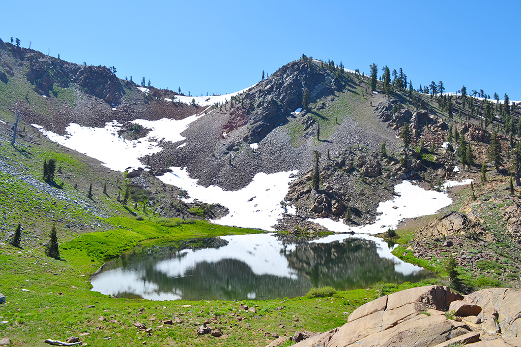
We setup camp and enjoyed the lake, relaxing for an hour or so and Jason even caught a fish. Then we set off with daypacks to complete the loop. Heading north from our camp we crossed the wildflower meadow. The trail gradually climbed uphill to reach another saddle overlooking Luella Lake. Snow was breaking off the bank and creating huge icebergs. This was already our fourth lake!
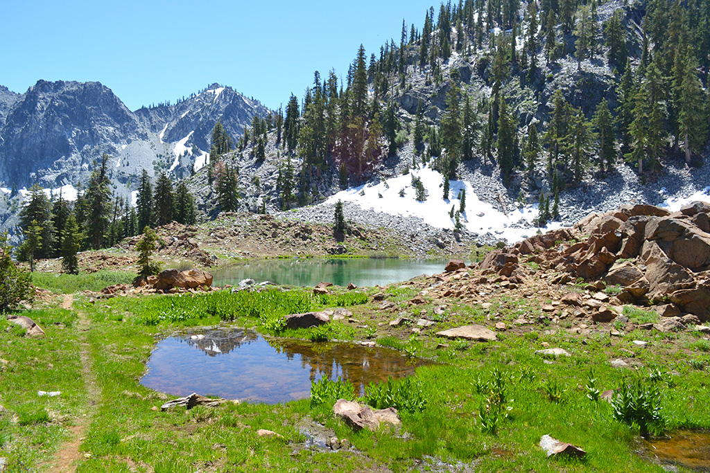
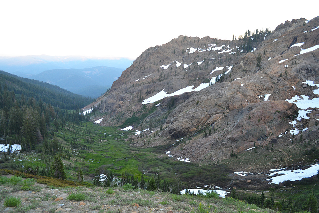
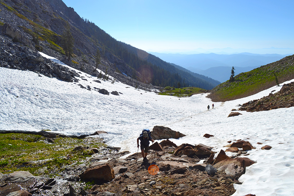
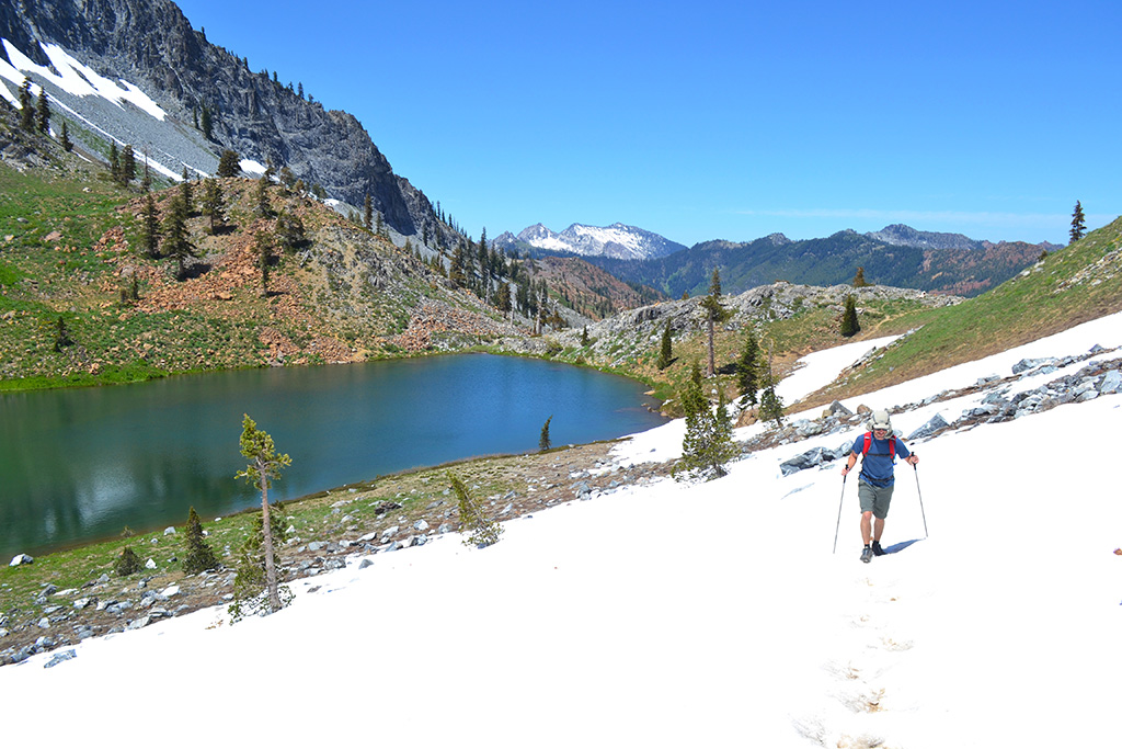
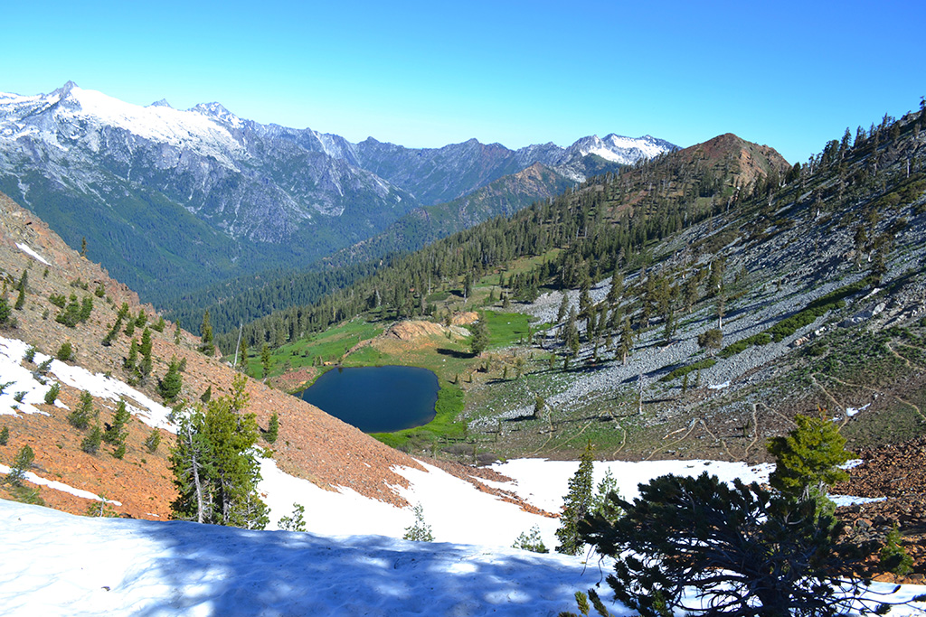
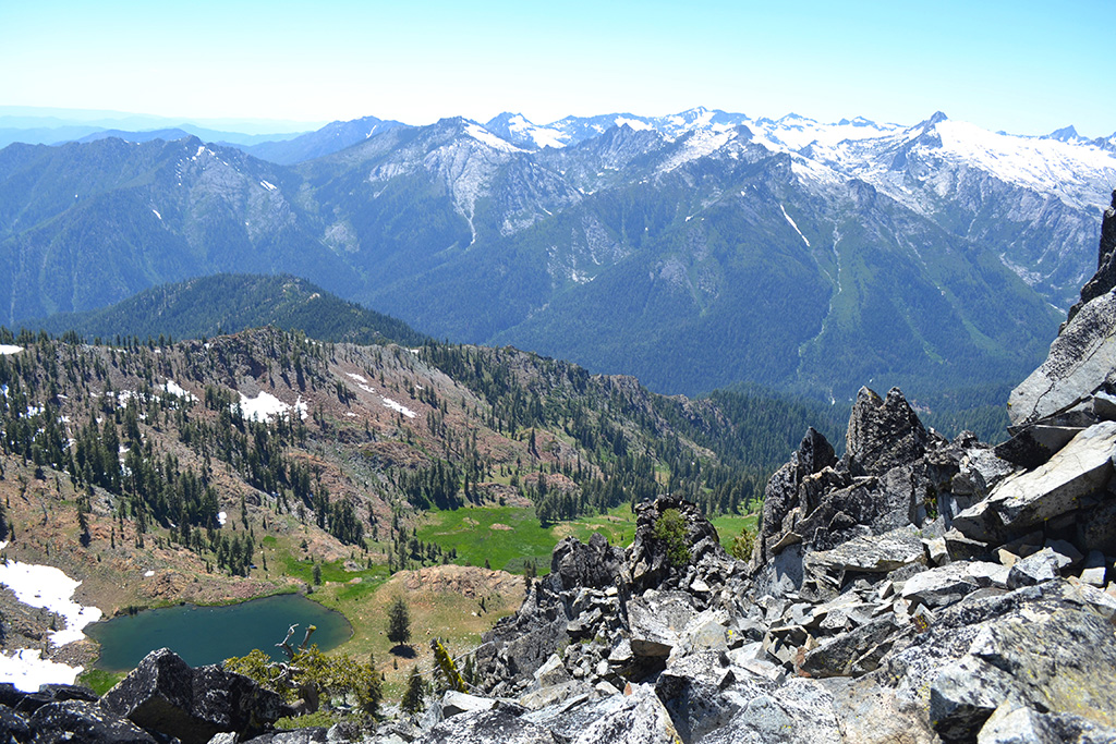
However the hike back to Deer Lake was the hardest section. First the trail descended all the way to the shore of Luella. We had views of red mountains to the north and a new meadow below. The trail continued all the way down to the meadow where we passed a smaller lake/pond before going up the other side toward Deer Lake again. This was a long uphill passing through several patches of snow.
We finally popped out at the outlet of Deer Lake where we stopped for lunch on the east shore. It was a perfect spot. We hiked uphill through more snow to the junction to finish off the loop and return back to our campsite.
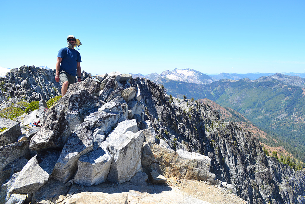
Siligo Peak (~0.5 miles, +300/-300 feet)
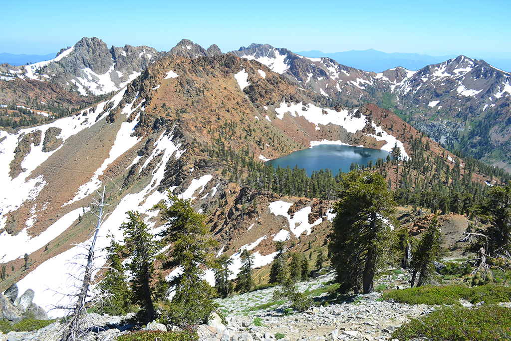
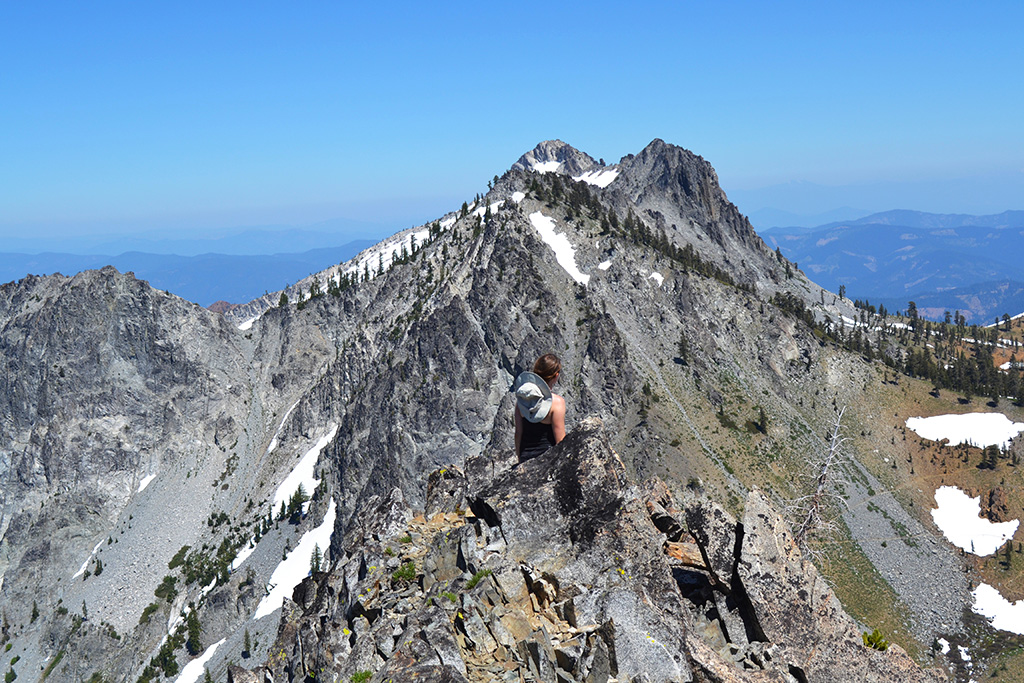
On our way back to Diamond Lake we turned off to the right just as we saw Summit Lake. A light use trail routed us uphill to the summit of Siligo, one of the best summit views I’ve seen. All the lakes but Luella were visible as well as more of the Alps, snow covered peaks, and even Mt. Shasta in the distance. I would highly recommend this quick side trip to get a panoramic view of the loop, the perfect way to end this hike!
After completing the summit we followed the use trail back to the main trail and returned to Diamond Lake for the evening. The next day we hiked back to the loop junction and down Long Canyon where I got to try out some glissading! I was reluctant at first but the snow patches were mostly low grade and it ended up being a lot more enjoyable than walking.
Logistics
This is an easy hike logistically, as long as the trailhead is a reasonable drive for you! The trail is a lollipop (out-and-back) with the loop at the end of the climb up Long Canyon. Since the loop is 5 miles it’s a manageable day hike and you don’t necessarily need to carry full backpacks around the entire thing, unless you would like to camp at the lakes. As mentioned above the most difficult stretch is between Luella and Deer Lake (or Luella and Diamond if hiking counterclockwise). And if you can, I would highly recommend adding on a Siligo Peak summit.
Permit
Self-issue wilderness and stove permits are required and may be obtained at the Weaverville Ranger Station. There are no trail quotas and the permits are free.
getting there
The Trinity Alps are approximately 10 hours drive north of Los Angeles or 5 hours from the Bay Area, a gentle reminder at how long the state of California is! From Redding follow CA-299 west to Weaverville. The Ranger Station is just off the highway.
From the Ranger Station follow CA-3 north 23 miles to Long Canyon Road. The trailhead is approximately 3 miles up the road, which is partially unpaved but was manageable in my sedan. When we arrived the parking lot was full and cars were parallel parked on the road.
There are several alternate trailheads available which can be found in the guidebook linked on this page.
Recommended Reading
Trinity Alps Wilderness Guide Book
This guide book covers 50 hikes and backpacking trips in the Trinity Alps, including the Four Lake Loop
>> Click here for my gear recommendationsUseful Links
Comments