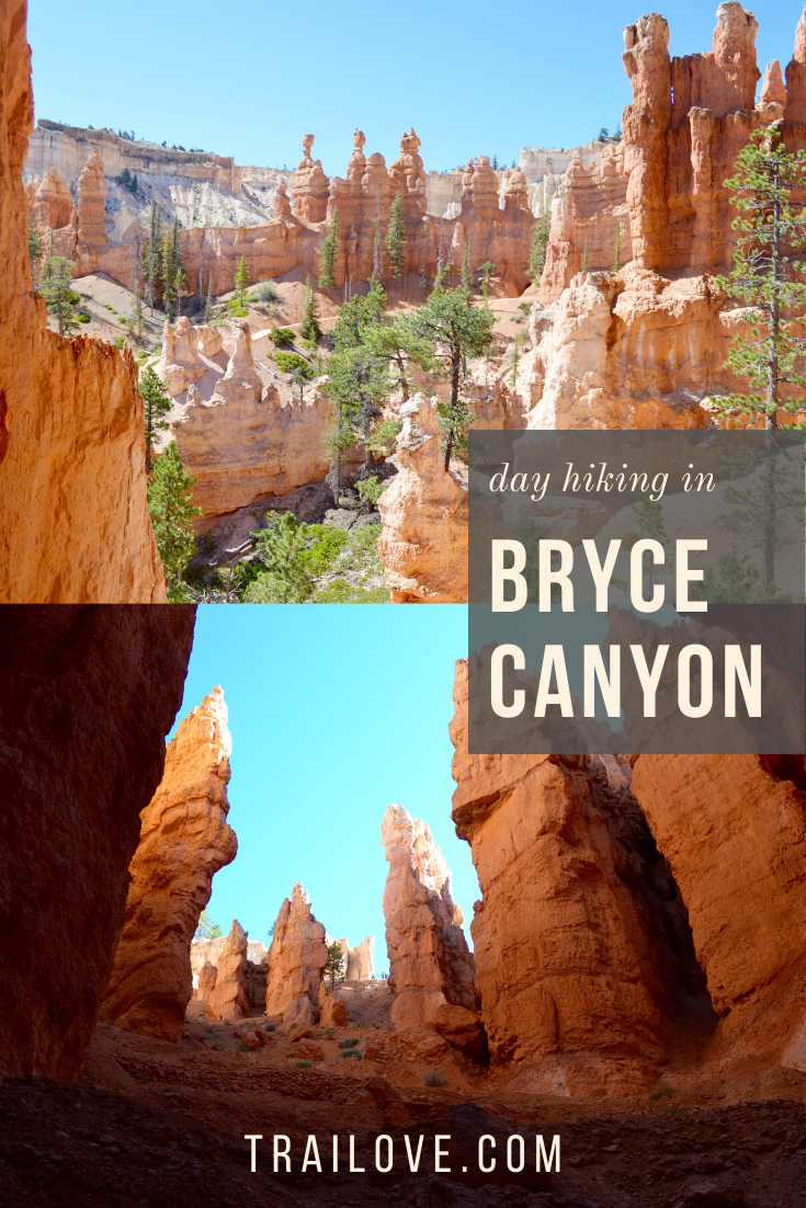
Bryce Canyon Day Hikes

Updated January 2020
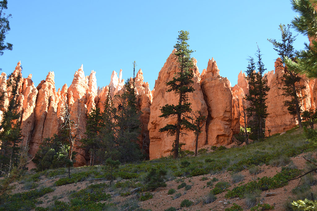
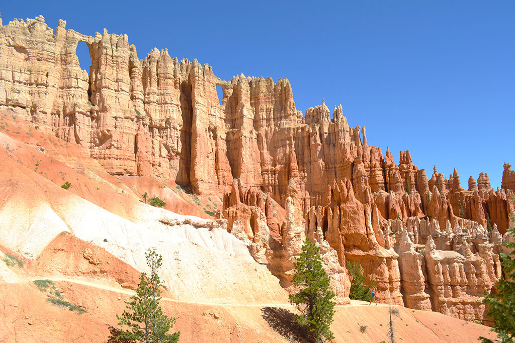
After visiting Zion I couldn’t wait to plan another road trip for more hiking in Utah. I had my eye on Bryce Canyon after great reviews from friends. Bryce Canyon is known for having the largest concentration of hoodoos - red towers of all shapes and sizes carved from erosion and weathering. On our trip we spent one night and a full day in the park, and squeezed in as much hiking as possible. The loop trails through the park are fairly short and well connected, each with its own special hoodoo monuments, so we were able to see a lot. The hikes in the main Bryce Canyon Amphitheater area range from 1.3 miles (Navajo) to 8.0 miles (Fairyland). Keep in mind the elevation of the park is around 8000’ and the trails drop down into the canyon, so even the short hikes can be taxing!
Important note: the hoodoos are disappearing over time, having been created by erosion they are also threatened by it. Make sure to stay on the established trails and never walk on or touch a hoodoo, even at its base!
Itinerary
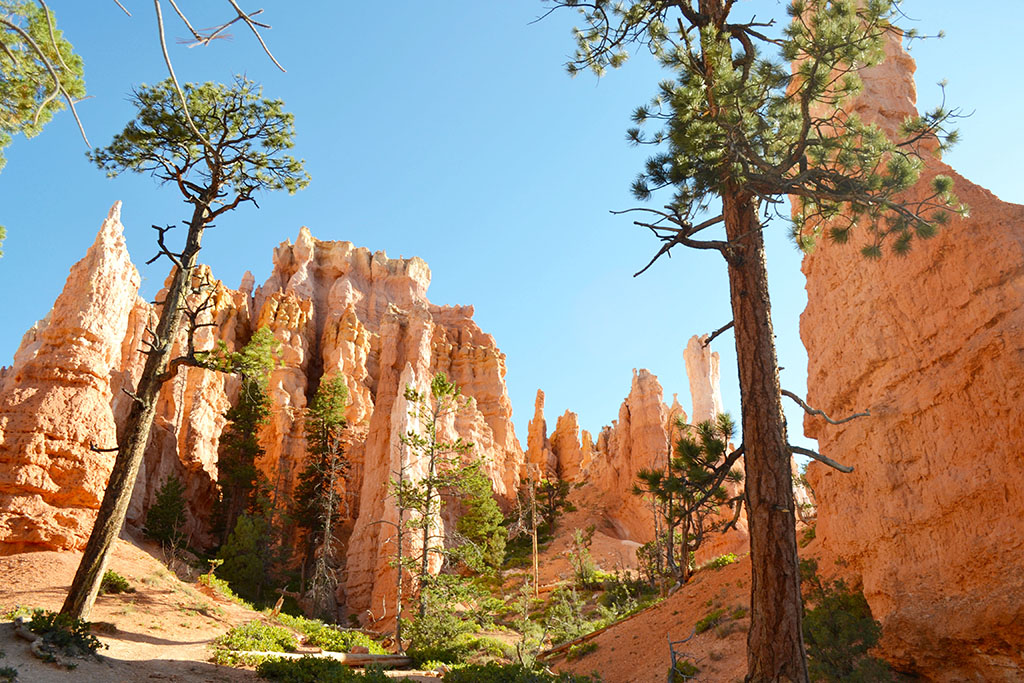
On our trip we visited Sunset Point on our first night, and Sunrise Point the following morning before hiking three trails: Queen’s Garden, Navajo Loop, and Peekaboo Loop. Our route was approximately 9 miles – starting down the Queen’s Garden trail, the full circle around the Navajo Loop, over to and around the Peekaboo Loop, back up the Navajo Loop, then along the Rim Trail back to our starting point. This page describes the trails and vistas we visited, but there are many other sights within the park.
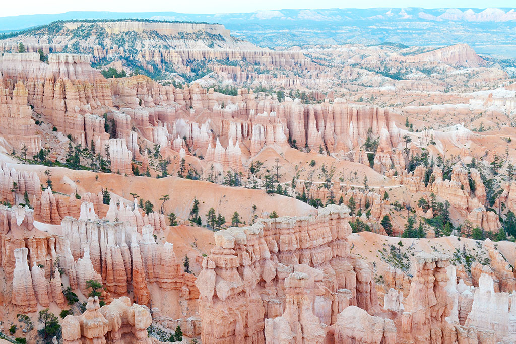
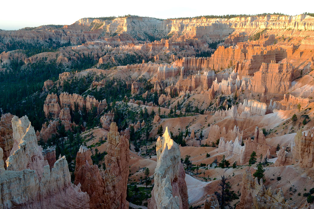
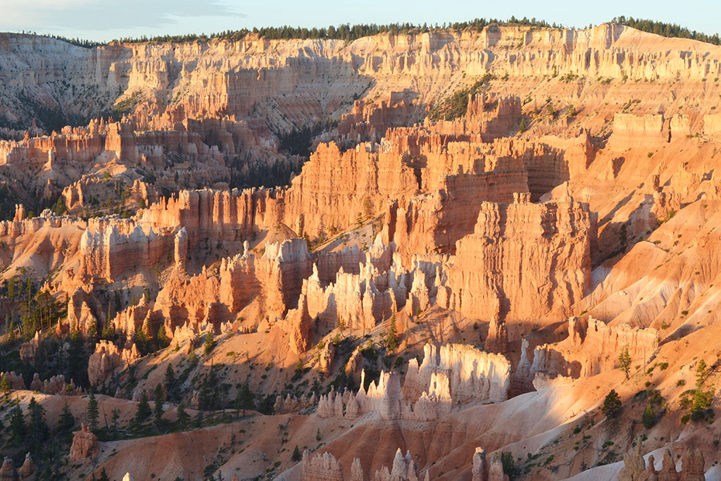
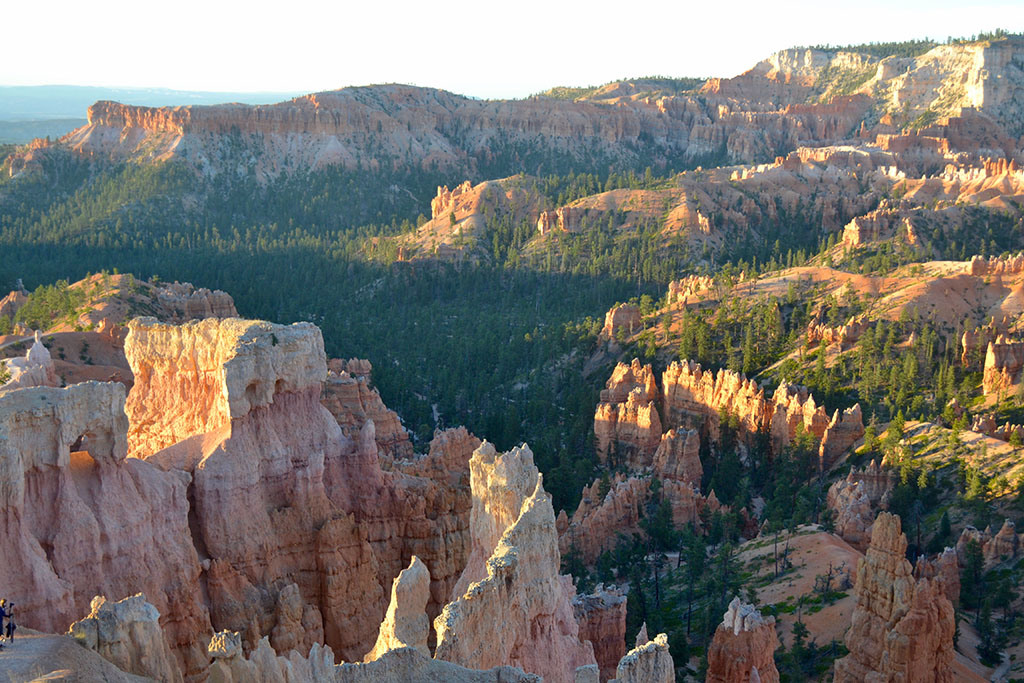
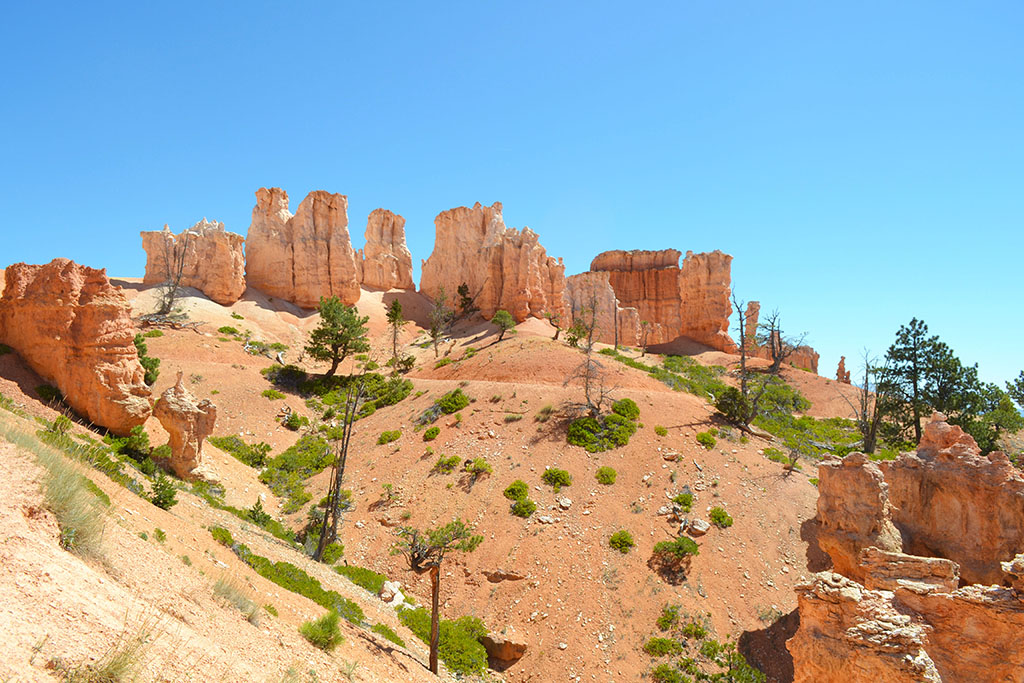
Sunset and Sunrise Points
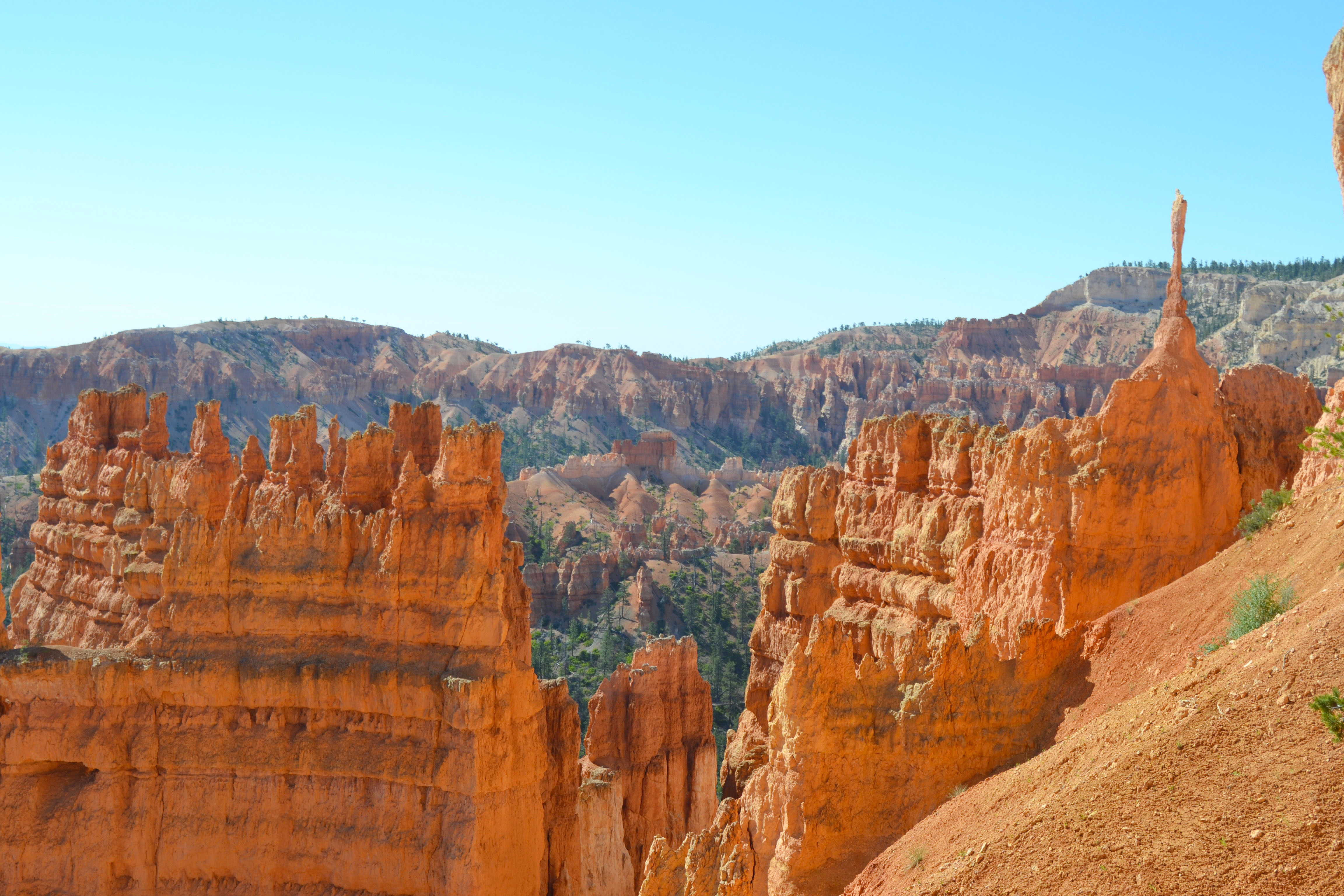
Sunset Point gave us our first spectacular glimpse of Bryce Canyon, into the dense hoodoos and trails we would be hiking the next day. It was a great vantage point for the whole Amphitheater area although it wasn’t particularly special at sunset! The next morning we had a better show at Sunrise Point, the first light of the day catching the tops of the hoodoos before we set off to get a closer look at them.
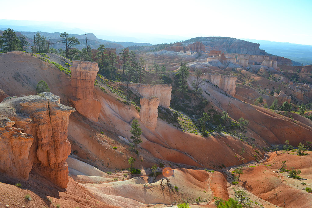
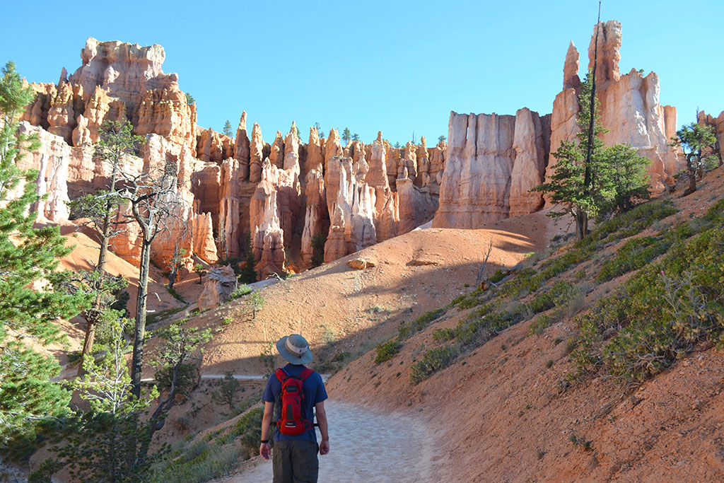
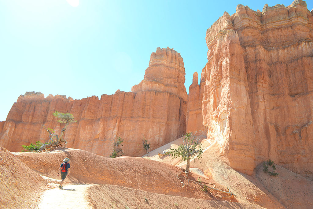
Queen’s garden trail (1.8 miles and 350’ descent one way)
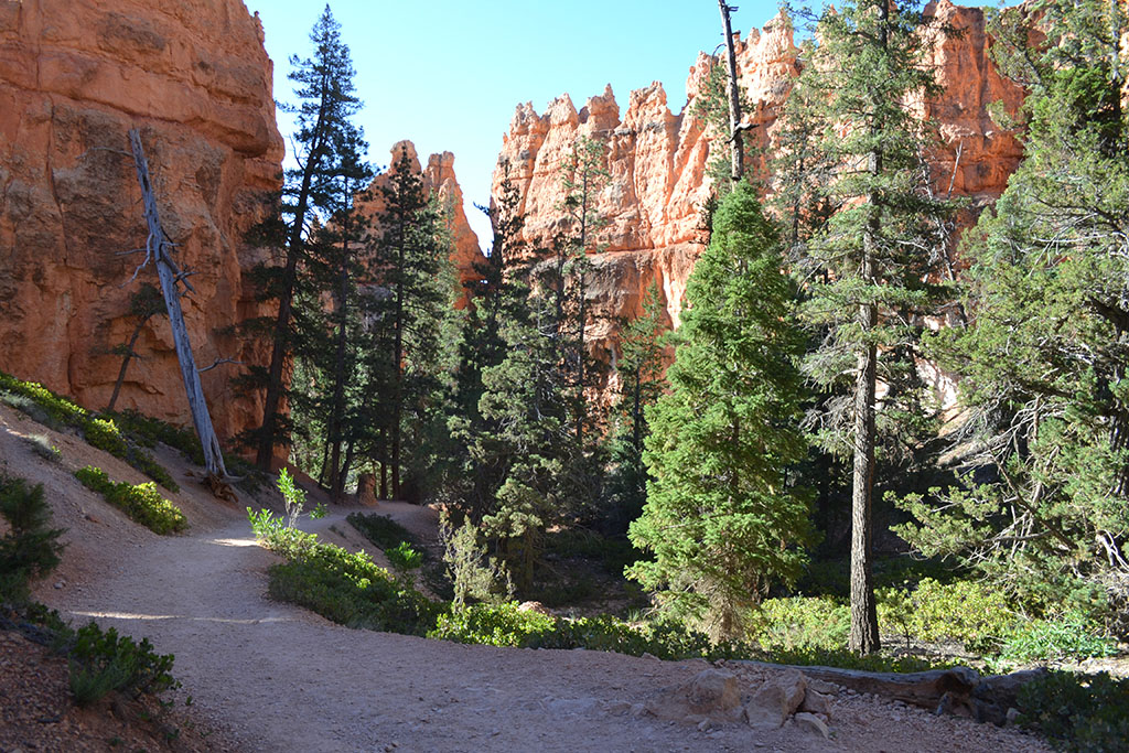
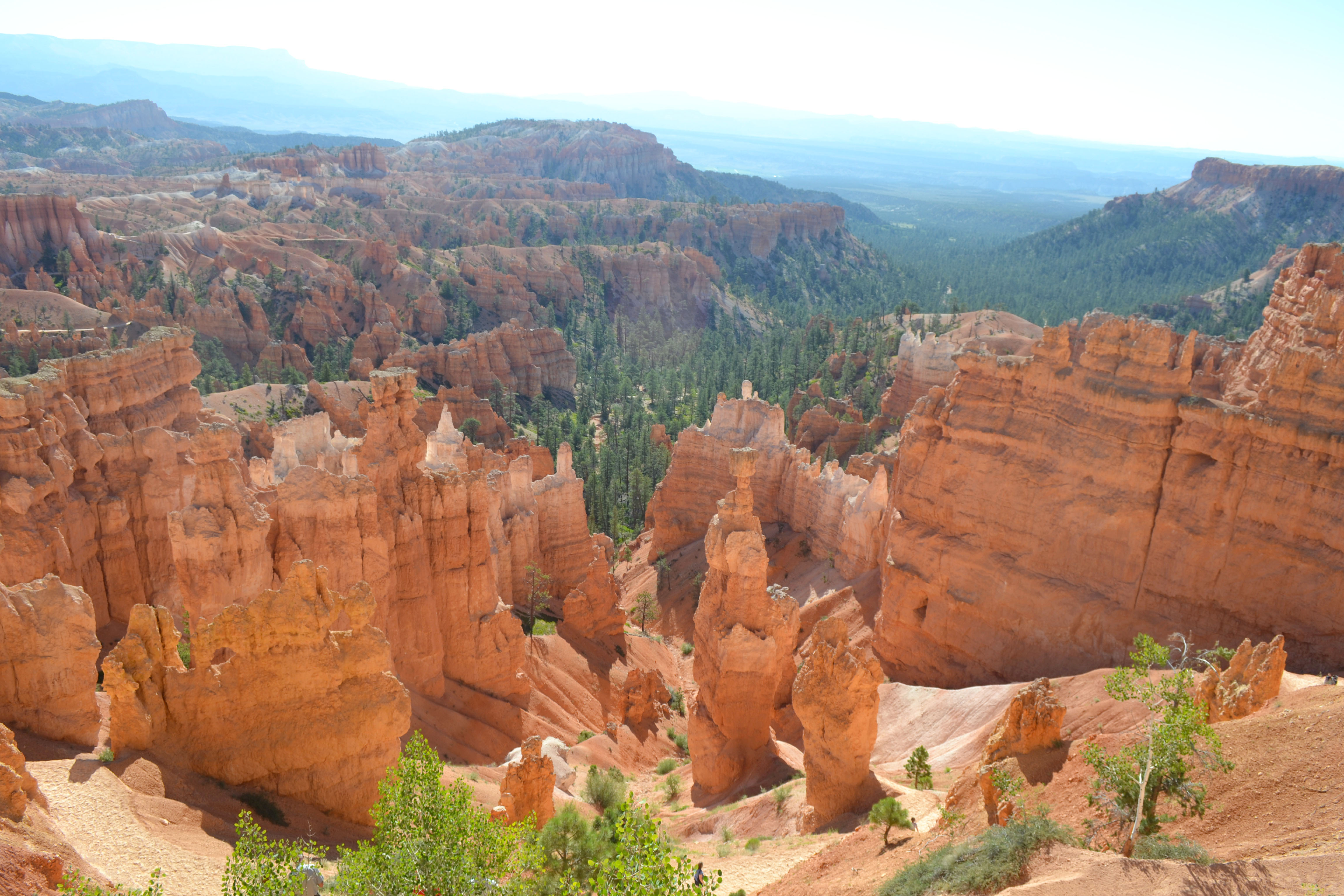
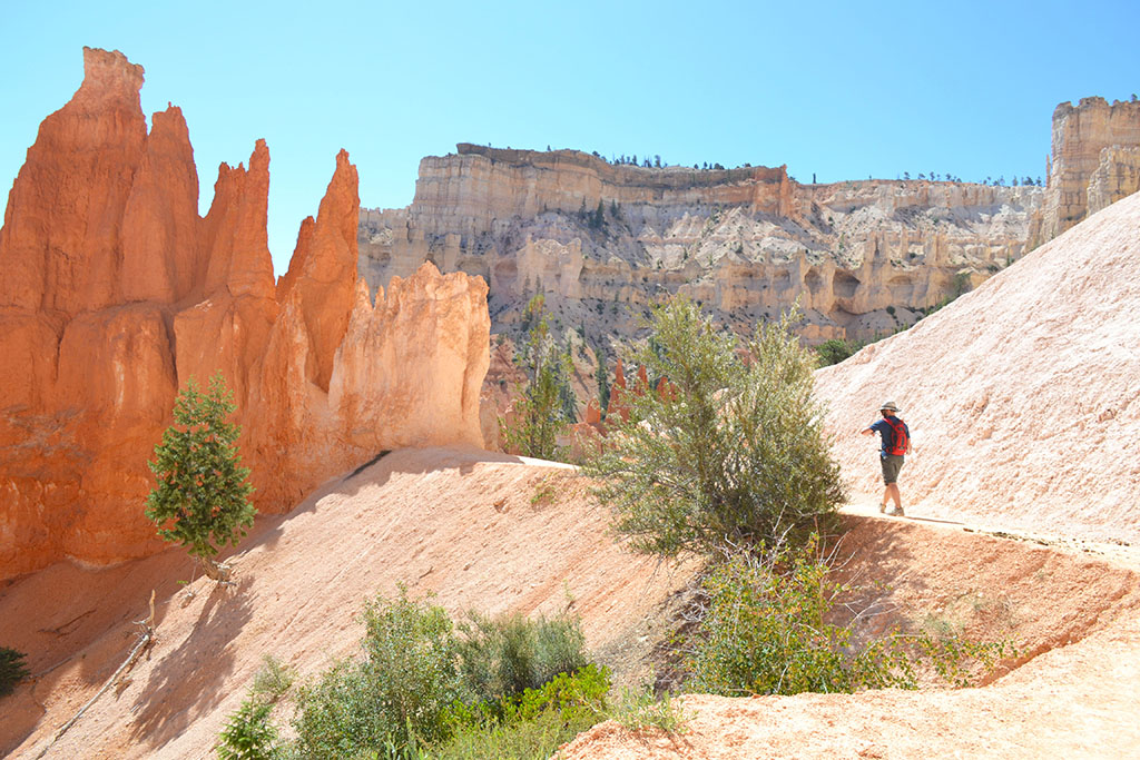
The Queen’s Garden Trail is an out-and-back hike that connects to the Navajo and Peekaboo Loops at the bottom of the canyon. The trail begins at Sunrise Point and immediately descends into the hoodoos, winding around their bases and even through doors carved within them. A little over a mile into the trail is the first major hoodoo landmark: Queen Victoria. The trail continues down into a forest of trees before reaching the junction with the Navajo Loop. You may be lucky enough to spot a deer like we did!
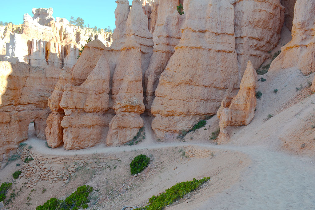
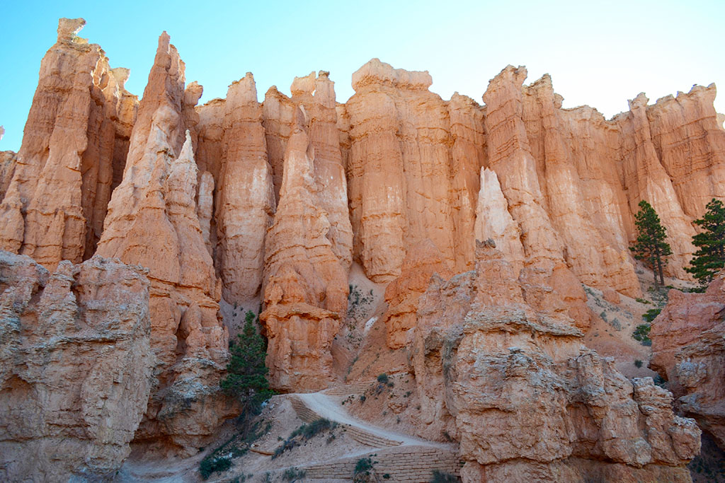
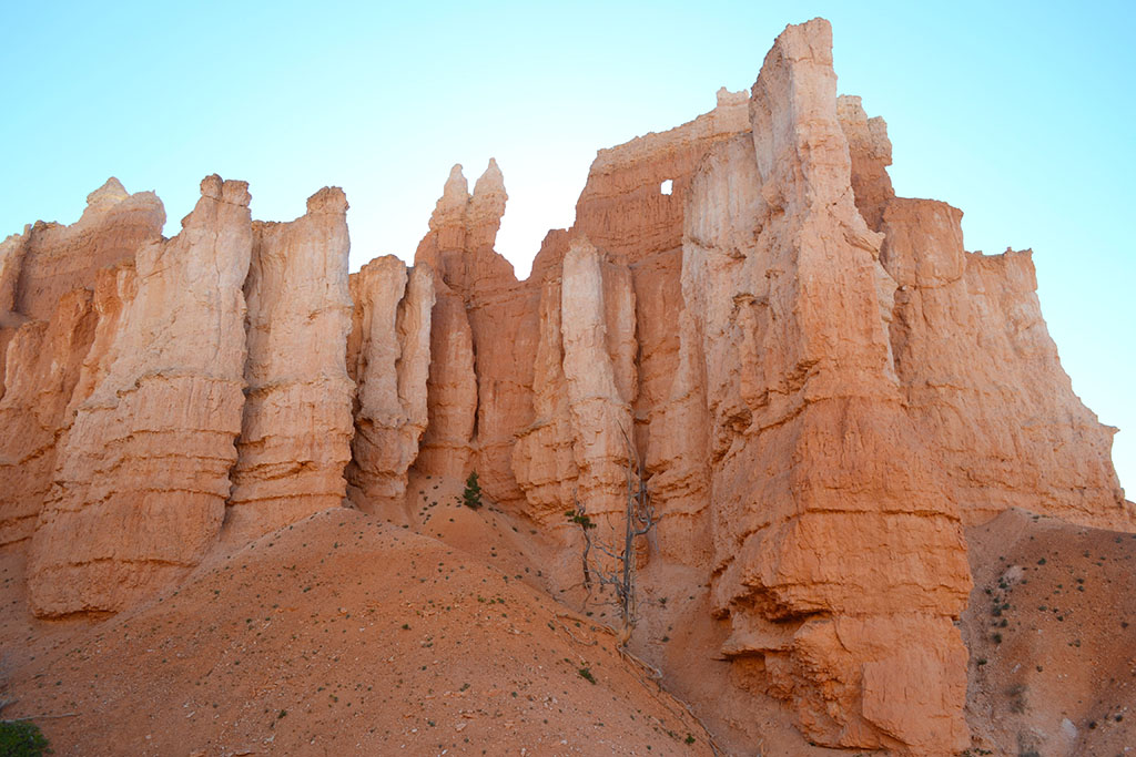
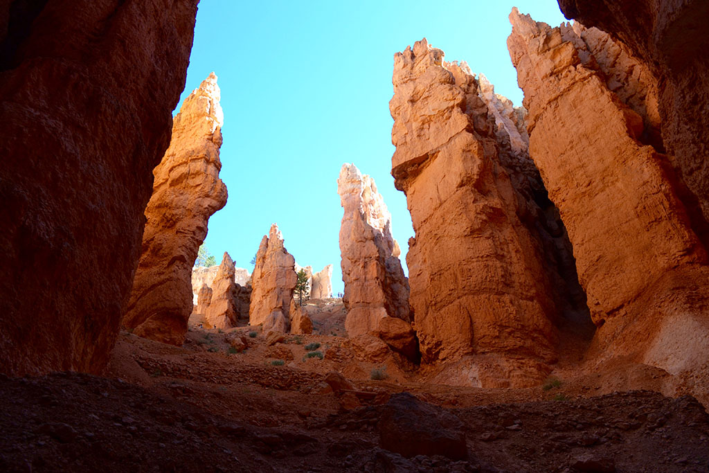
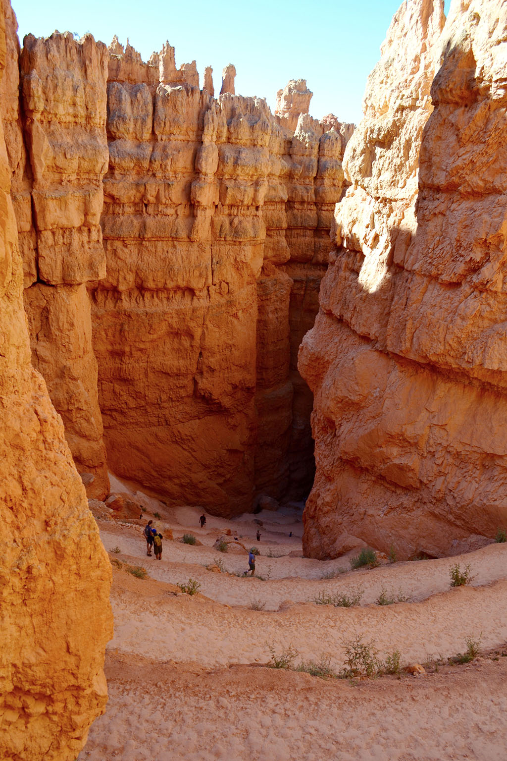
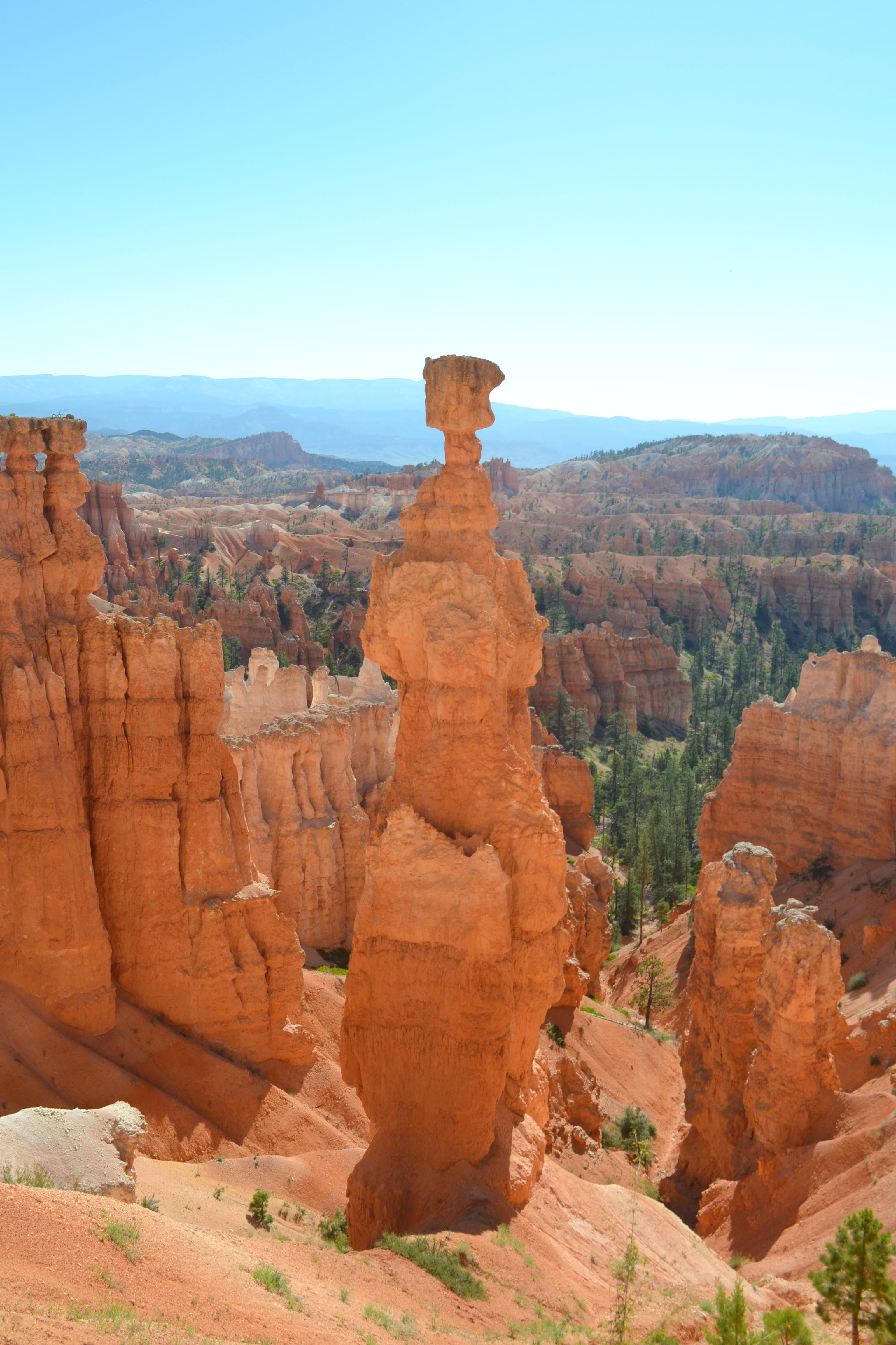
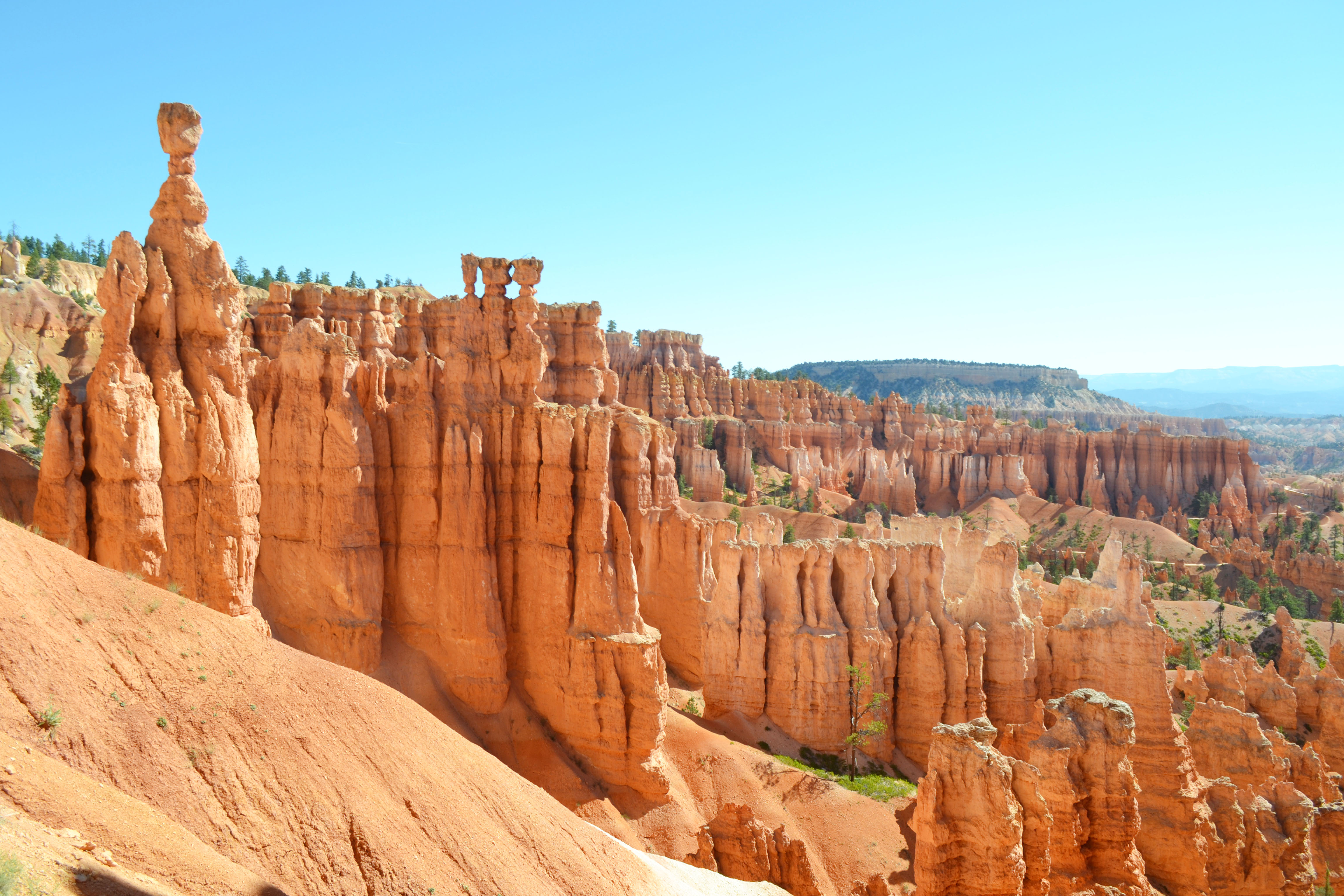
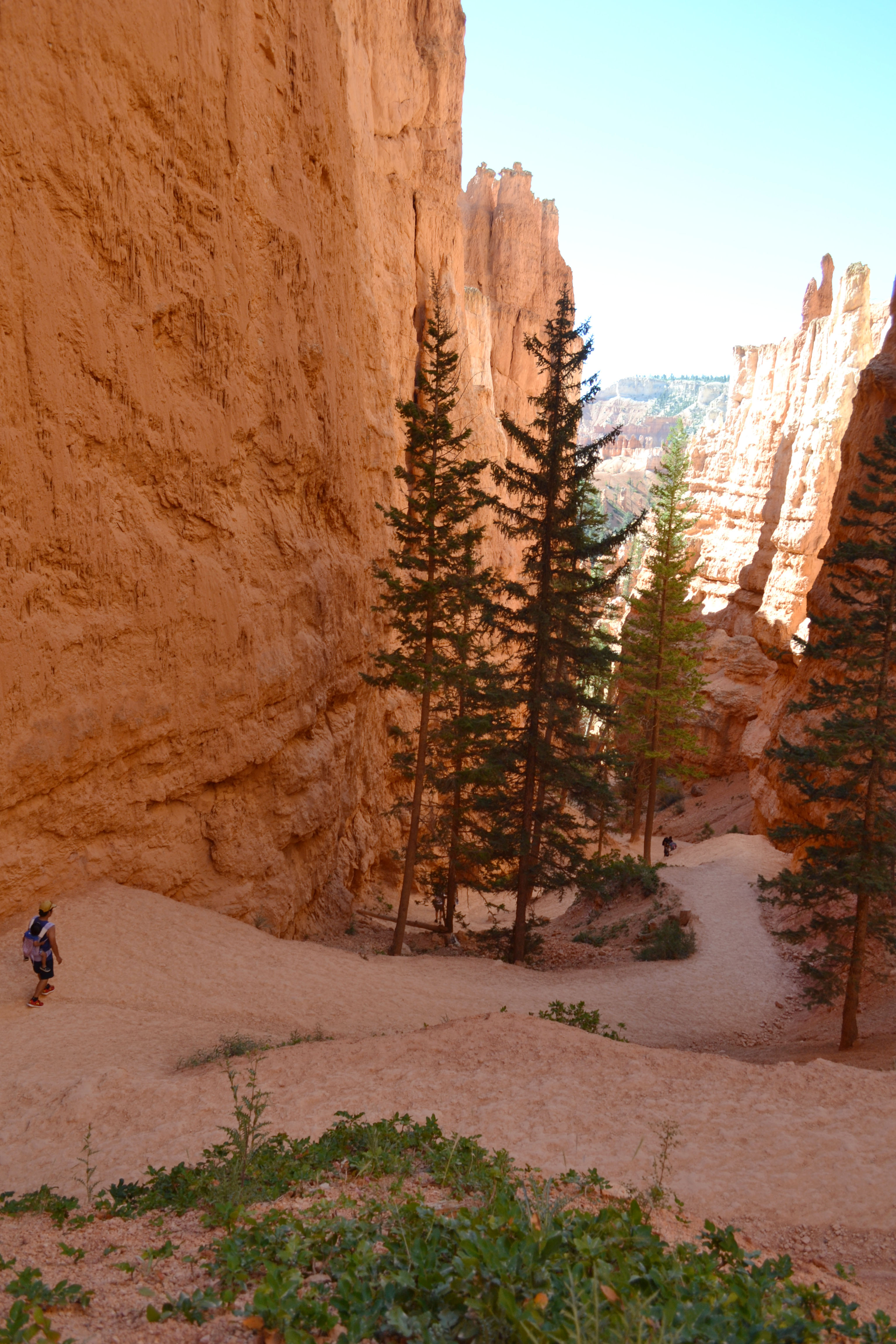
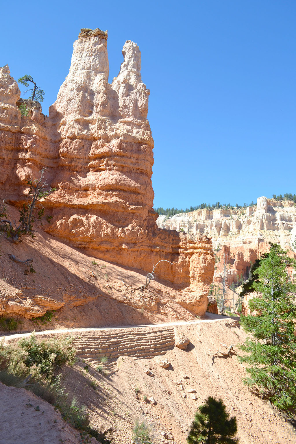
Navajo Loop (1.3miles and 550’ gain/descent)
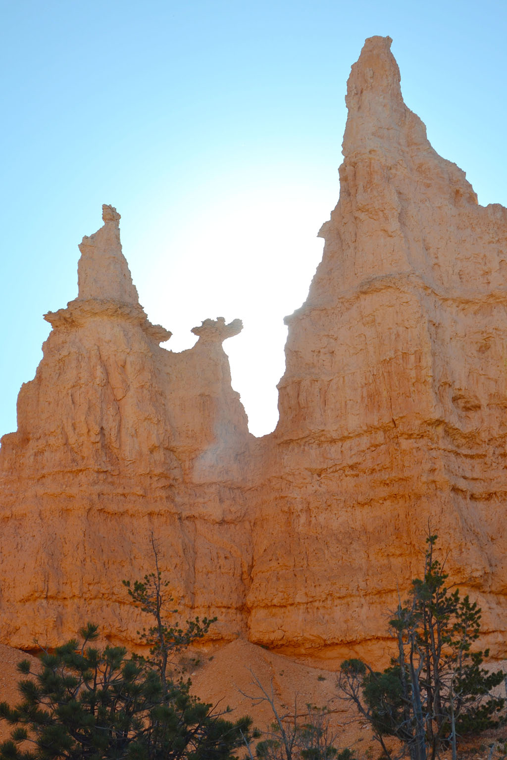
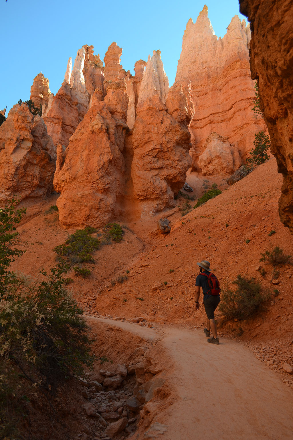
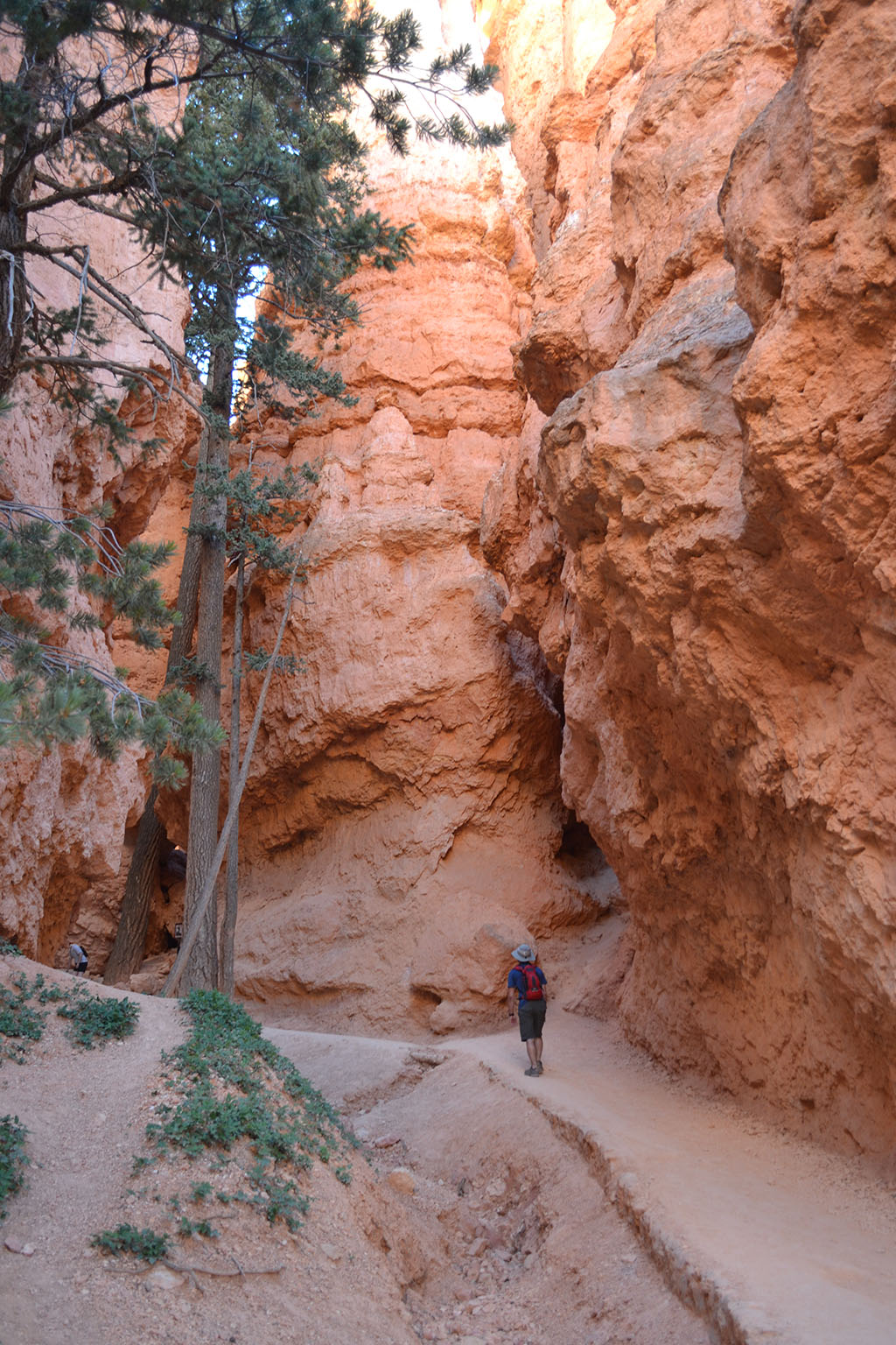
The Navajo Loop seems to be the best bang for your buck if you have limited time to hike within the canyon. The loop wanders through tight corridors of hoodoos, including the especially narrow Wall Street. It also features recognizable hoodoos like Thor’s Hammer and Two Bridges. We looped around this trail once and ended up back down at the junction within the canyon. You can also begin this hike from the Rim Trail near Sunset Point.
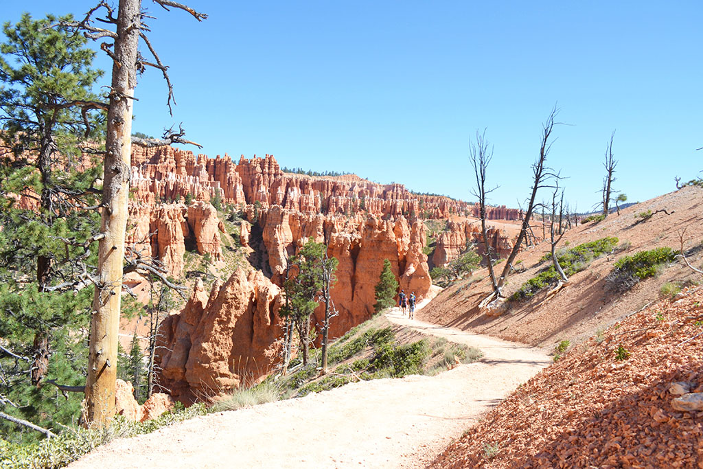
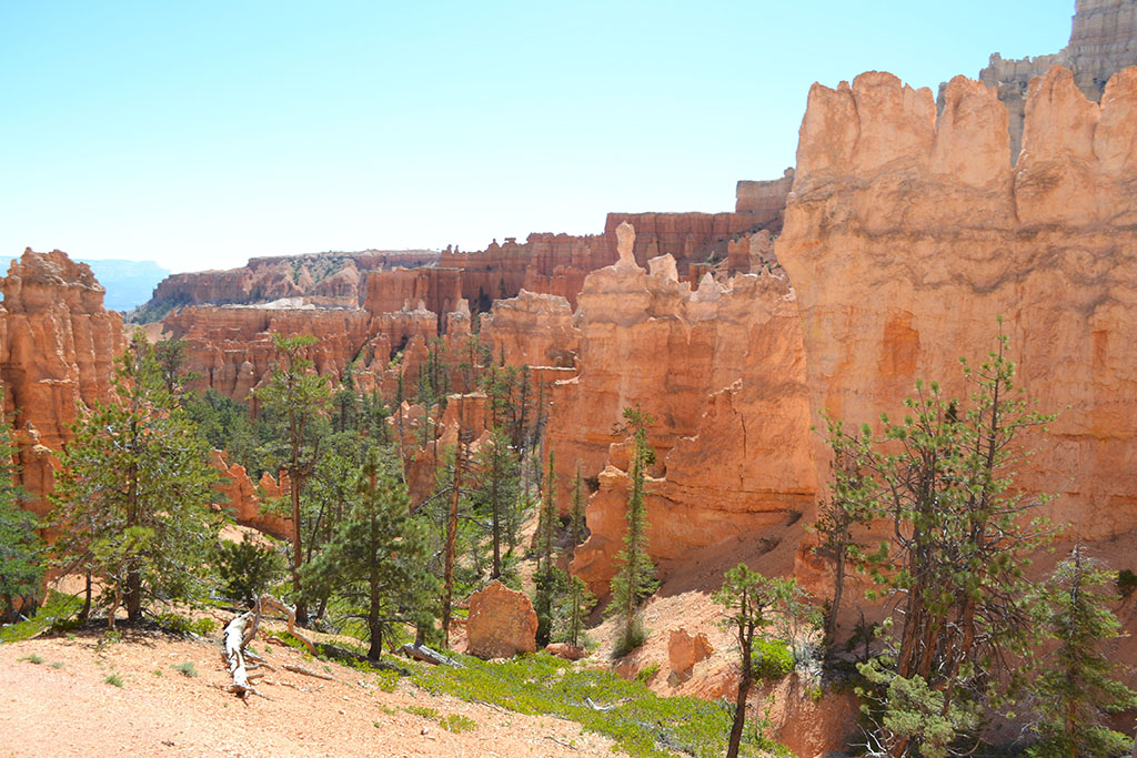
Peekaboo Loop (3.5miles including spur trail, 1600’ gain/descent if going all the way to rim)
We took a short spur trail from the junction over to the Peekaboo loop, a less crowded option compared to the other trails. You can also hike this trail from the rim by starting from Bryce Point, but be aware of the elevation change if you are starting the hike downhill first. The Peekaboo loop includes prominent hoodoo landmarks like the Cathedral and the Wall of Windows. The Cathedral ended up being one of my favorite areas – it felt like a sacred manmade monument from a different planet. At the end of the Peekaboo loop we returned to our car via one side of the Navajo Loop and along the Rim Trail.

Logistics
Permit
Permits are not required for day hiking in Bryce Canyon. When hiking the loop trails, check the ranger provided map for the recommended direction to hike. Overnight backpacking trips require backcountry permits but campsites are limited. Refer to the Backcountry Info page for more details. Lodging and car camping are also limited within the park, and some sites may be reserved in advance. View the Park's Campgrounds page for more information.
getting there
Some of my favorite recent memories have been our road trips from Los Angeles to new parts of Utah. From LA, it’s about a 9 hour drive to Bryce Canyon. The route passes through Las Vegas which can be a nice half way stopping point. You can also pass through Zion National Park without significantly impacting your travel time. Grand Staircase-Escalante is another 1hr drive past Bryce Canyon.
Season
Bryce Canyon is open year round but can have some pretty intense weather concerns in every season. Here are a few things to watch out for as you plan your trip:
- Winter conditions: snow is typically present from December through February which can result in road closures. From October through May temperatures are below freezing at night and snow storms may occur. Campgrounds and certain hiking routes are also closed or altered in the winter time, check the Useful Links section or the map provided in the park for more details.
- Heat: in the summer months the average high temperatures can approach 80F. The temperature coupled with the elevation and exposure on the hikes can be brutal. Make sure to bring plenty of water.
- Thunderstorms: lightning and thunder are common on summer afternoons and can be deadly. If you observe either, head for shelter and do not go hiking.
Recommended Reading
Bryce Canyon Trail Map
Maps are provided at the ranger station, or order a more detailed map like the one above
>> Click here for my gear recommendations
Comments